
Four days in Alcova, Wyoming…
Why we came…
To fish the North Platte River!
The campground…
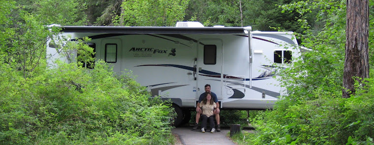
We stayed at the The Reef Fly Shop. They have 15 RV sites. All of the camp sites have electric and five have full hook-ups. The RV sites are new and oriented back to back…not a configuration that we like. We were comfortable because we had no neighbors. The sites were grated during our stay which smoothed out drainage problems like large puddles, ditches, and tire ruts. More gravel would be very useful to ease the sloppiness after drenching rains. The bathrooms and showers are also fairly new and in good shape. The Reef Fly Shop is the only option in the area with hook-ups. There are multiple campgrounds along the river, and a few on Alcova and Pathfinder Reservoirs with no hook-ups but in prime spots. If we go back for another short stay and target Fremont Canyon again, we’d stay at either Black Beach campground on the east side of Alcova or Weiss campground on the northeast end of Pathfinder.
The town of Alcova is small with a population of 76 at an elevation of 5,371 feet. There is a gas station/convenience store/grill and not much else. Casper, Wyoming’s second largest city, is roughly 30 miles to the northeast, and has a good selection of restaurants and stores.


That’s us camped behind “The Reef Fly Shop” near Grey Reef Reservoir

Alcova Reservoir after a late spring snow storm
Adventures…
")
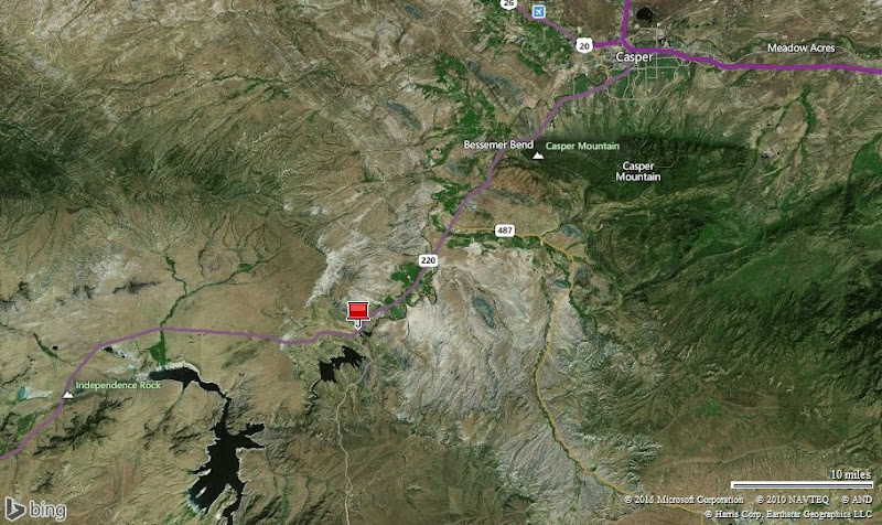
Click the map for better detail
The North Platte River flows north out of Colorado into central Wyoming where it is impounded by four dams. Cold clear water flows from the dams creating perfect conditions to feed lots of trout. The river is reported to have 7,000 trout per mile averaging 16-17 inches. Rainbows make up 90% of the population. Browns and cutthroats make up the last 10%.
We were going to fish the “Grey Reef” section, but focused on Fremont Canyon instead. The reasons: very few people, no drift boats, dramatic scenery, and bigger trout. Most of the canyon is rimmed by 200 foot cliffs. Access is challenging with tricky routes required to get to the river. Once you get safely to the water, you’ll likely be alone, and have an opportunity to tangle with trout over two feet long!
The flow on the lower river was low. During our stay, the flow upstream on the “Miracle Mile” was 1,800 was cubic feet per second (CFS) and only 500 CFS downstream in the Grey Reef section. There is no data for Fremont Canyon, but based on water lines on the rocks, it was quite low.
In two days we fished three different spots in Fremont Canyon and were successful in each one. We caught two brown trout and about 20 rainbows. They averaged 15-19 inches, but I lost a 22-24 inch rainbow that put up a great show before it got off. The trout were feeding mostly on size 20-22 midge pupas, but a few hit tiny nymphs, and I caught four on a big black woolly bugger.
Spot #3 was especially memorable. The canyon walls tightened, forcing the water through a deep, 20 foot wide gap. The water-sculpted rocks rose vertically out of the river with rounded ledges 4-10 feet above the water. Fortunately there was one small ledge less than a foot above the water that allowed us to land the trout. When fishing the head of the run and hooking a fish, we’d scamper carefully across the top of the 10 foot ledge and drop down to the small “landing ledge”. It was tricky and challenging! The sweet run treated us well. We hooked 7 or 8 from the “landing ledge” and 7 or 8 from the head of the run. A long-handled net would have been very handy!
Fremont Canyon and the North Platte were outstanding! We had a very memorable adventure.

About to drop into Fremont Canyon to spot #1 on 18 May 2015

Arleen fishing the North Platte River in Fremont Canyon

Fishing the North Platte River in Fremont Canyon

We caught 4 or 5 nice trout from this beautiful run.

Fighting a big rainbow trout. (Click the picture to zoom in and see the fish.)

Great picture!


A football-shaped 14 inch rainbow trout and a rare brown trout caught at spot #1

About to drop into spot #2 in Fremont Canyon on 18 May

Looking down to that spot. We caught 5 or 6 trout in this great run.

Arleen casting into spot #2 on 18 May

Arleen fishing spot #3 on 20 May 2015. Note the water-sculpted rocks.

We caught about 15 trout in this run. To land them we had to go up and over the rocks and drop to a small ledge with access to the water…it was quite challenging! I called it “extreme fly-fishing”.

Arleen fighting a trout and about to drop to the “landing ledge”

Fighting another nice one on the “landing ledge”. See the trout?


Very pretty, very healthy, and very strong rainbow trout. They averaged 15-19 inches. I estimated my last fish to be 22-24 inches long. During the five minute battle, the monster rainbow trout jumped three times, winked at me, and got off. It was a great way to end a great adventure!
Check out our short video: “Extreme fly-fishing in Fremont Canyon of the North Platte River”

Independence Rock
Independence Rock, Devil’s Gate, and Mormon handcarts …
It was a dreary day with the temperature in the upper 30s and wind-driven rain. Instead of fishing, we went on a driving tour.
Many western pioneers carved their name on Independence Rock in the mid-1800s as they headed west on the Emigrant Trail.
“Windblown sand and silt have grooved the rock and polished it to a high gloss in a process called "windfaceting." It is because of this smoother surface that the pioneers were able to easily carve their names into the rock. It was the names carved in stone here that caused Father Peter J. DeSmet to appropriately name this place "The Register of the Desert" in 1840.”
Just a few miles from Independence Rock, the Sweetwater River cuts a narrow 100-meter deep slot through a granite ridge. The prominent land mark along the Emigrant Trail was called Devil’s Gate.
Just south of Devil’s Gate is Martin’s Cove and the Mormon Handcart Historic Site.
“In November 1856, about 500 Mormon emigrants in the Martin Handcart Company were halted for five days in the Cove by snow and cold while on their way to Salt Lake City. Although the number who died in the Cove is unknown, more than 145 members of the Martin Company died before reaching Salt Lake City.”
We were soggy and cold, but much better off than the Martin Company. We learned a bunch and had a good day!


Does she look cold? It was 38 degrees with wind-driven rain / Inscriptions on Independence Rock


Devil’s Gate / Pulling a Mormon handcart
Next…
We we were supposed to spend six days near Walden in Colorado’s North Park. Due to persistent rain the campgrounds were mud bogs so we decided to head straight to Grand Lake, Colorado. We will spend five weeks here at the western gateway to Rocky Mountain National Park and the Indian Peaks Wilderness. We hope to backpack to high alpine lakes, but that wont happen unless the sun starts to shine and the mountain snow melts!
Parting shots…


We watched these ospreys build their nest near the campground / Pronghorns near the North Platte River


American white pelicans were common along the North Platte River. (This is the Grey Reef section that we did not fish.)
(81,000)