

Two weeks in Ouray, Colorado…
Why we came…
Because Ouray is a cool town and to explore the nearby San Juan and Cimarron Mountains.

Ouray, Colorado sits in a spectacular box canyon
The campground…
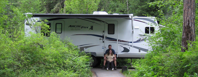
4J+1+1 RV Park was ok. We chose it for its location in town. Most of the sites are packed in uncomfortably tight. It didn’t help that many folks brought two vehicles, or additional ATVs, or motorcycles. Unfortunately that’s standard across much of the region. We had full hook-ups, slow and unreliable wi-fi, and a strong Verizon 4G data signal. The bathrooms and showers were decent and kept clean. There were three reasonably priced clothes washers and three clothes dryers. Despite the lack of space, the reasonable nightly rates and convenient location made it worth it. Nearby are two other full service campgrounds that also looked decent. If hook-ups aren’t important, there are some really nice Forest Service campgrounds in the area. We’d love to come back, but would try one of the other full service campgrounds, especially if we could get a bigger site.


Packed in like sardines in our first camp site / Our second site was much better


The campgrounds and San Juan Mountains are overrun by obnoxious toys
Nearby towns…
Ouray, population 1,000 and elevation 7,792 feet, is a scenic town with a rich mining history. There is one small grocery store and nearly 20 restaurants. There are a bunch of touristy “gotcha” shops, a few artsy shops, and an old theater. There are multiple outdoor adventure shops that guide the area’s famous four-wheel drive routes and rent four-wheel drive vehicles. Ouray is also known for its hot springs. There are four different ones in the area. Like most of the Colorado Rockies, the town is quite busy during the summer and offers a host of events. If you plan to visit Ouray in July or August, make campground or lodging reservations months in advance!

Everything in Ouray was within an easy walk from the campground (right side of picture)

The main Hot Springs sits on the northern edge of town
Montrose, population 19,217 and elevation 5,807 feet, is the main supply town, 35 miles north of Ouray. It has most services and stores, including a big Walmart, Home Depot, City Market, and Safeway. There is a good selection of restaurants, a charming downtown, and regional airport.
Adventures…
On 24 July we hiked up to the top of Baldy Peak..
Our first Ouray hike was just north of town. We think that the U.S. Geological Survey could do some work on naming of peaks and lakes. There are five Baldy Peaks in Colorado alone. Our goal was the Baldy Peak five miles north of Ouray.
We got to the trail head by parking at an open camping area at the end of County Road 14 and walking a half mile up a 4-wheel drive road. We signed the trail register, and the trail pitched up immediately. It was a narrow, overgrown path with Gamble Oak lining the trail almost two thirds of the way up. The trail beyond the ridge overlook was faint but since we were above the trees, it was easy to find our way.
10,503 foot Baldy Peak is south facing and it was pleasantly warm on top in the sun. The view from the top was very impressive. We could see Courthouse, Chimney Rock, Wetterhorn Peak and Mount Sneffels to name just a few.
We were pestered by swarms of biting flies but also saw many pretty butterflies and flying ants. We quickly signed the peak log noting that we, surprisingly, were the first people to sign in five days.
After we made our way back to the ridge, we looked for the Storm Gulch Trail to do a loop back. From using satellite it looked like the trail ran along a spruce covered ridge. A perfect place to harbor our mushroom treasures!
We backtracked back and forth for a bit because the trail was so faint and we did not see any signs. Once we were in the spruce and aspen forest it was easy to follow. Almost immediately we found a nice group of oyster mushrooms on a dead aspen. Then we saw a few aspen boletes, not what we were looking for, but an indicator that our mushrooms might pop up any day! It might be our lucky day!
We followed the ridge for over two miles and though it looked promising, we did not see any more treasures. We descended Shortcut Trail to complete our loop. Unfortunately, the trail is very eroded, muddy, rocky and steep. We gave up on the idea of returning the following week to see if any more mushrooms had sprouted. It was hard enough with the use of trekking poles, never mind carrying a basket full of mushrooms.
All in all it was a good 9 mile loop. We did make a mistake. We did not take into account that we had planned this hike all along ridges without access to creeks to get fresh water. We each carry 42 ounces but for a hike like this we need more than that. At the first creek crossing, we should have each drank a full bottle and then filtered more or carried more with us. By the time we circled back to the creek, we were parched.


Hike route / Our first time in the Uncompahgre Wilderness


Headed up to Baldy Peak. Matterhorn and Wetterhorn peaks in the background / Mount Sneffels, 14,150 feet high, looms ahead

Posing on top of Baldy Peak


The survey marker at 10,603 feet / Signing Baldy Peak’s register


Oyster mushrooms. We ate them that night! / Grouse / Aspen boletus mushrooms
On 25 July we hiked into Silver Basin…
We drove out of Ouray towards the famous Yankee Boy Basin for six miles on County Road 26. At first it was a smooth dirt road but it gradually narrowed and had a few harrowing overhangs and drop-offs. This area once again has active silver mining which has led to controversy over recreational use of the very popular road.
We parked at the Imogene Pass turnoff. There, a 4-wheel drive road climbs over the pass to Telluride. We may be back with a jeep in another ten years to do that. Today, we walked up to Silver Basin on a different narrow, rocky, steep 4-wheel drive road. As we walked up, we had to move over from time to time to let rugged vehicles pass. At one point we ran across two tour trucks that had dispelled a few dozen passengers who were all trying to get pictures of some very pretty flower-lined waterfalls. We chatted with the drivers for a few minutes and one of them shared a few secret waterfall spots off the road.
As we climbed the rocky road, we followed his directions. And we were so glad we did. Each spot sheltered pretty falls decorated with moss and wildflowers. We had them all to ourselves!
Finally, after 1,700 feet of climbing, we reached a pretty turquoise lake in Silver Basin. Unfortunately, two more tour trucks arrived at the same time and the passengers swarmed the area. We found a rock cropping to take a break and wait them out.
Even their presence could not take away from the view; the lake with a 13,000 foot ridge behind it that included the impressive United States Mountain. All of this was adorned with the largest variety of Paintbrush we have ever seen.
After the trucks left, Arleen noticed the rapidly darkening sky and declared it “go” time. I insisted on walking around the small lake first. She stayed in place to get a few pictures and then hustled down the trail.
We were just a few yards down the road when the first rumble reverberated amongst the ragged San Juans. The next BOOM was way too close! We hurried down the rocky steep road as quickly as we could. We stopped and quickly adorned our rain pants and jackets. Soon after, it began to rain heavily and then switched to small hail. Temperatures often drop 20 degrees with mountain thunderstorms and it’s best to avoid getting wet and cold.
As we descended, the rain slowed so we detoured off trail to get a sense of how “shroomy” it was. It was the most promising area we had seen around Ouray so far. Everything else was so dry. We decided to give it a week to fruit and return before we left the area.


Hike route to Silver Basin / Telluride is just over the pass, a very popular four-wheel drive route


The waterfalls, streams, and flowers were beautiful


More flowers and small streams


The lower lake / Headed to the upper lake


The flowers were incredible around the upper lake

A nice break at the upper lake

Looking down at the lower lake

Arleen at the upper lake. Shortly after we took this picture, there were two ground shaking cracks of thunder and small hail!
On 27 July we hiked to the Mount Sneffels Overlook and then into Blaine Basin…
We parked at the Blue Lakes Trailhead, 17 miles southwest of Ridgeway on County Road 7. The trail register indicated nobody heading our way, but there were many folks headed up to Blue Lakes. We would be back for those.
We peeled left and followed the Dallas Creek Trail for two and half miles. The first mile is an ATV trail before it turns left and we turned right on the foot trail. The trail undulated through spruce forest along the creek. It was very pleasant and the fact that we were all alone made it even more special.
We turned left at the next trail junction. The route pitched up and became rocky but we were still in the pretty spruce trees. After a mile and 500 more feet of climbing, we saw the sign for the Mount Sneffels Overlook.
As we climbed another hundred feet, we stepped out on a rocky outcropping and one of the most fabulous views we have ever seen opened up before us! We could see Mount Sneffels, 14,150 feet high, surrounded by his friends, Cirque Mountain, Kismet, and Blaine Peak. It was such a beautiful place to hang out for a while and we had it all to ourselves.
After getting an eyeful, we headed back down to the Dallas Fork and then headed south towards Blaine Basin. We meandered through a lovely spruce forest again but steadily climbed 600 feet over a mile. Because we had already done 5 or 6 tough miles, it was a bit of a challenge. We took a break to look up a new flower, the Wood Nymph.
As we broke out of the forest, we could see a picture perfect meadow with a creek babbling through it and wild flowers everywhere. Above the meadow was the last part of the climb with a hill covered in a baby spruce tree patch. The original trees were probably cleared for mining.
After the last climb, we took a break in the pretty basin, craning our necks straight up at Mount Sneffels. There were a few others folks that we met on the trail but we had the basin mostly to ourselves and enjoyed the serenity.


Hike route to Sneffels Overlook and Blaine Basin / First we’re going that way

A spectacular view from the overlook


Now we’re going that way / We enjoy meandering trails through spruce forests


Flowers, waterfalls, and clear mountain streams in Blaine Basin

Happy to be in Blaine Basin. Mount Sneffels is directly above Arleen. We could see folks up there with our binoculars.
On 28 July we hiked to the West Fork Pass and into the Wetterhorn Basin…
Today we were going to visit John Wayne’s old stomping grounds amid the scenic Cimarron Range. His movie True Grit was filmed in the Ridgeway area. A few prominent Cimarron Range monoliths such as Chimney Rock and Courthouse Mountain are easily recognized in the movie.
We drove east over Owl Pass on County Road 10. Just beyond the pass, we made a right turn onto the West Fork Road. It was a decent but narrow dirt road for two miles and then deteriorated into a rocky 4-wheel drive road the final mile and a half. We parked with a few other cars where the road turned crappy.
We already expected a lengthy hike with a bunch of climbing and now we added another three miles. Arleen was happy she hauled her water sandals along since we had to ford the West Fork of the Cimarron River.
At the trailhead, somebody recently wrote “wildflowers be poppin’” in the trail register. Well, that was something to look forward to!
After an easy half mile amble through spruce forest, the trail opened into a marsh and meadow area. And sprinkled all around were Tall Bluebells and a large herd of hot pink Elephant Heads. Recently we had seen a few Elephants here and there. Now with the acre-sized herd, we realized that they were very fragrant! As we took pictures, we met Bob and Sarah. We would leap frog them the rest of the day, each time learning a bit more about each other. By the end of the hike, we had some great new friends!
After that the trail pitched up a little more for two miles but was very pleasant with the shrinking West Fork running through fields of “poppin’” wildflowers. We found a perfect sitting rock, filtered water, and stared at the steep boulder field looming ahead along the West Fork Pass.
We were surprised to meet our campground neighbor on the trail. He had spent three days backpacking in the area with his eight teenage grandchildren. They also did some trail maintenance to create a new route through the boulder field we were about to negotiate.
As we hit the base of the steep scree slope, we could see the old route and silently thanked our neighbor. We have done a bit trail work ourselves, and know it’s tough! In a short half mile, we climbed about 500 feet, right at Arleen’s vertical limitation.
We made it to the pass, elevation 12,545 feet, and the view was well worth our efforts! We had left the West Fork Basin behind and we’re gazing down and across the expansive Wetterhorn Basin. We took a lunch break up on the east side of the Pass where we could look at the basin ringed by several peaks but not the namesake Wetterhorn peak.
After lunch, I scrambled another half mile down to a scenic point and Arleen moved to a spot just above and west of the pass. From these spots we both had a great view of Wetterhorn Peak. 14,015 feet high.
Arleen took her pack off, relaxed, and tried to get pictures of me on the distant overlook. Suddenly, a strong gust of wind hit and her pack tumbled over. It proceeded to snowball down the hill a hundred feet, expelling all its contents as it rolled. She was laughing about it by the time I got back, and I was just tankful that she didn’t roll down the hill with it. Bob and Sarah were nearby. They heard Arleen get excited and saw the backpack spiraling down. For a split second, they thought they were witnessing a disaster!
We crossed to the north side of the Pass and reentered the West Fork Basin, leaving the strong winds behind. By the time we crossed the river and got back to the truck, it was late. Too late to try fishing the West Fork but I hoped we could make it back another day to give it a try.


Hike route to West Fork Pass / Just 3.1 more miles to the pass. The last mile is tough!


The huge field of Elephant Head flowers was fragrant / We rested at the base of this waterfall and filtered water


More incredible fields of flowers as we climbed

Getting higher into the West Fork Basin

Still higher

See me towards the center of the picture?

Arleen just conquered the hardest part of the trail just below the pass

At West Fork Pass, elevation 12,545 feet. Looking south into the Wetterhorn Basin.

A panoramic shot of the Wetterhorn Basin

Standing on a point and looking west towards Mount Sneffels

Headed back down. Prominent landmarks, Courthouse Peak and Chimney Rock in the background.
On 29 July we hiked to all three Blue Lakes…
We returned early one morning to the Blue Lakes Trailhead. This time we took the right towards the popular lakes. Our goal was to see all three Blue Lakes and to catch a few cutthroat trout.
We were surprised how the trail immediately pitched up. It steadily climbed 1,600 feet over the next three miles. The entire route was through mostly spruce forest following various small streams. Higher up the drainage where the trail began to level, we briefly popped into the open for views of impressive waterfalls and the surrounding peaks. We took a break halfway up with a view of a meadow where a bear had recently been reported. Unfortunately, the bear did not make an appearance.
The incredibly pretty lower Blue Lake sits at 10,920 feet. We spotted quite a few tents nearby. Even though it was early, several backpackers were already headed down and many day hikers and a few fishermen were spread around the lake. I went to the south side of the lake and tried floating a few terrestrials to a couple of clearly visible trout but they weren’t interested. Lake One: strike out. Well, there were two more lakes.
I caught up to Arleen on the trail above the lower lake. The route from Lake One to Two was steep and rocky, climbing 600 feet in a half mile. But with each turn we were surrounded by wildflowers and got an incredible view of the lake below. It appeared to morph into more amazing shades of blue as we climbed. It really was one of the prettiest lakes we have ever seen!
We arrived at the middle lake and I headed to the upper inlet while Arleen stayed up on the high slope to get pictures. Lake Two was smaller and more of a clear green color but still a very picturesque alpine lake. Best of all, it contained cooperative fish! I stood in a field of wildflowers consisting mostly of columbines and cast my fly into a brisk wind. In just an hour I hooked 10 cutthroat trout measuring 8-14 inches long. It was fun fishing!
Finally, we hiked to the upper lake. It also was a pretty alpine lake, though the most shallow. I made a few halfhearted casts on the east shore but did not see any fish.
Arleen took position up on an old moraine above the west shore where she could get a good view of the steep, rocky switchbacks leading east to Blue Lakes Pass and Yankee Boy Basin. It was a shorter way back to Ouray, but much more difficult. Far above to the left, we could easily see the peak of 14,150 foot Mount Sneffels and a few brave climbers scrambling twenty-five hundred feet above us!
The wind had picked up and cumulous nimbus clouds were rapidly growing to the south. Thunderstorms could hit anytime. It was “go” time.
We were amazed on the way down at the number of backpackers who were headed up the trail! It was a Friday and we imagined there would be many campfires around the lower lake that night. At the trail register, Arleen noted that 63 people had signed in that day to hike to Blue Lakes. And not everyone registers. That is far more than we see in most wilderness areas but we could see why Blue Lakes was so popular.


Hike route to the Blue Lakes Basin / Just 3.3 miles and 1,700 feet of climbing to the lower lake


There were nice stretches of trail through spruce forests / We like the Mount Sneffels Wilderness!

About a mile and a half from the lower lake. Mount Sneffels, 14,150 feet high, looms far above

Flowers lined the banks of the lower lake. I saw cutthroat trout, but couldn’t coax them to bite.

The lower lake is an incredible shade of blue. This view is on the way up to the middle lake.

Approaching the middle lake

A whole field of flowers, mostly columbines, lined the middle lake near the inlet stream

Fly-fishing the inlet stream in a stiff wind


An inlet stream with a deep drop-off and gentle bank is a perfect place to fly-fish alpine lakes / I caught 10 cutthroat trout, 8-14 inches long, on small grasshopper flies.

Climbing above the middle lake

The upper lake. Mount Sneffels towers another 2,500 feet above (on the left)

Another view of the upper lake. Saw one or two trout, but didn’t get any bites.


The view above the lower lake is one of our favorites!
On 1 August we wandered around Chimney Rock…
The first John Wayne movie I ever saw was “True Grit” when my mother-in-law, Ellen, sent it to me in Iraq. We wanted to get into the old west spirit. So, we watched True Grit the night before we set out to the Cimarron Range again.
The monolith formations in the Cimarron range are so craggy and unique in the San Juans. We parked near the trail head for Courthouse Peak which was being “guarded” by a herd of cows.
First, we set off to climb a closed dirt road just east and directly below Chimney Rock. Our objective here was to look for some mushrooms in the spruce forest. The road climbed quickly and we soon had fabulous views of the prominent land mark.
We ducked in and out of the woods. We tried to cut across the mountain slope but nearly ended up being “cliffed out”. We did not see one mushroom. In fact, it all was quite dry. We hoped that the long range forecast and its promise of several inches of rain in the next week would hold true. We did see deer, elk, and bear poop and were thankful to follow well-worn game trails.
We returned to the truck and I grabbed my fly rod. I worked my way up a short stretch of the West Fork of the Cimarron River. I only saw a few pockets of water that might hold fish. Unfortunately, I saw no signs of fish. Because the small stream flows into Silver Jack Reservoir a few miles below, I imagine trout move upstream to spawn in spring and fall. The West Fork might have more interesting fishing then.
Arleen had gone ahead to get pictures and to also poke into the woods to look for fresh mushrooms. After I decided that the fishing would be fruitless, I joined her. It looked like a “shroomy” spot but it was still too dry. We did see a whole bunch of moose poop in the willows along the stream.
As we headed back we herded some cows ahead of us and noted the sun sinking behind Chimney Rock and Courthouse. It gave us that old west feeling again. We could just imagine a gang of outlaws hanging out along the pretty stream.


Hike route near Chimney Rock / Lots of messy cows graze the area during summer


Posing under the imposing Chimney Rock


Fly-fishing the West Fork of the Cimarron River


Our picture of Chimney Rock / Scene from the original “True Grit”
On 2 August we hiked up to the old Brooklyn Mine…
We had two goals this day. First, we wanted to find the first mushrooms of the season. Along the way we wanted to do a reconnaissance mission of the famous yet daunting Million Dollar Highway. “It is really the twelve miles south of Ouray through the Uncompahgre Gorge to the summit of Red Mountain Pass which gains the highway its name. This stretch through the gorge is challenging and potentially hazardous to drive; it is characterized by steep cliffs, narrow lanes, and a lack of guardrails.” We would need to pull our little home over the Highway in a few days when we moved to Silverton.
We left around 8am to see what the traffic was like at that time. It was not bad at all. Of the 25 miles between Ouray and Silverton, only about 5 miles is a challenge for towing. The area with no shoulder and a LONG drop made Arleen’s stomach lurch. Note: When we drove north in late afternoon, there was a lot more traffic that included huge motor homes, fifth wheels, and commercial trucks. If they could do it, we could do it with our 30 foot trailer!
It is a very impressive road with spectacular scenery composed of the rugged San Juan Mountains, waterfalls, and old mining relics and history.
A few miles north of Silverton, we took a turn up the Brooklyn Mine Road and parked. It was open to all vehicle types but we were leery due to the rugged reputation of most of the roads in the area. So we left our huge Dodge truck behind and walked the 2 miles and 1,500 feet up the road to the remnants of the mine.
We poked around the old Brooklyn Mine living quarters and tried to imagine what it would have been like to live up here as a miner in the late 1800s and into the 20th century. It would have been rough and very cold during the winter. But the views would have been hard to beat.
Like other peaks in the area, the mountain had a high iron content and was quite red. The mountains along the west side of the drainage were green up to timberline and contrasted significantly compared to where we stood. And still there were colorful wildflowers everywhere.
We ambled around in the spruce forest above the mine but did not see any signs of our mushrooms yet. Though, it was comforting to see that the soil was moist. Any day… Any day…


Hike route to old Brooklyn Mine / Looking out one of the old building’s windows

High above the Mineral Creek drainage and Highway 550. Looking north towards Red Mountain Pass.

The Brooklyn Mine is in the upper right corner

Near the base of the mine


Checking out the old mine buildings

A panoramic view from near the mine
On 3 August we went back to Silver Basin to hunt for mushrooms…
We returned to Silver Basin to mushroom hunt. Like our previous visit, we were under pressure with a forecast of afternoon thunderstorms.
We wandered around the nice looking spruce and fir forest. We saw a few “LBMs” (little brown mushrooms) and one amanita, a sign that shrooms were starting to pop. Sadly, we did not spot any chanterelles, porcinis, or hawkwings.
We did see that the entire area was “signed” for the Ouray 100 Mile Endurance Race taking place in two days. In less than 52 hours, the competitors would cover 102 miles on foot and climb nearly 42,000 feet! We discussed how amazed we are at what the human body can endure and what the logistics would be for such a feat. Note: On the morning of the event, I saw a few of the athletes rapidly walking the road near the campground and wished them luck. I explained to a fellow camper what the runners were going to do. His question was, “Really! Where will they sleep?!?”


Mushroom hunting route near Silver Basin / Remains of the Atlas Mill back-dropped by Stony Mountain
Next…
We have spent three weeks in Silverton and will finish our Colorado Rocky Mountain summer with five weeks in Pagosa Springs. After that we will spend ten days at Navajo State Park, NM, and will make our way to Zion National Park by late October.
Parting shots…

The 25 mile section of Highway 550 between Ouray and Siverton is known as the “Million Dollar Highway”. It’s got an interesting history and is known for its scenery, tight curves, and sure-death drop-offs. The two primary legends of its name are: “it cost a million dollars a mile to build in the 1920s, and that its fill dirt contains a million dollars in gold ore”.


A “Bearing Tree” for navigation / “Ouray 100 Endurance Run” competitors will cover 102 miles on foot and climb nearly 42,000 feet in less than 52 hours!
(111,550)