

Ten days at Needles Outpost, gateway to “The Needles” of Canyonlands National Park…
- The drive…
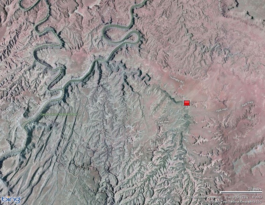
It was only 65 miles from Blanding to the Needles Outpost. However, it was very scenic. The thirty something miles of highway 211 were a bit tough with steep winding sections, no shoulders, free range cattle, and a bunch of cattle grates, but we took it slow and admired the scenery. There was very little traffic on the road, so we pulled off a couple of times for pictures. We got more and more excited as we neared our home for the next 10 days!


- Campground…
The Needles Outpost is remote! They have a few supplies, expensive gas, a water filling station, a shower house, and a dump station. There were no hook-ups and no cell phone signal, but slow wi-fi was available near the office/store. Portions of the campground roads and most of the sites were soft sand which made maneuvering a bit challenging. Each campsite had a good amount of space and privacy. We had an excellent view out the front window and an impressive red sandstone cliff out the back (see the following pictures). Our solar kit and batteries struggled during 2-day periods of cloud cover. (We cheat when that happens…just connect the trailer to the truck with the engine running for 15-30 minutes, and the charge provides a few extra hours of power.) The campground was very peaceful and dark at night. Walks with our dog were very pleasant, though there were a bunch of bunnies that drove him crazy. We were just two miles from the Canyonlands National Park visitor center and a convenient 5-10 mile drive to the amazing hikes trailheads. We were surprised at the campground’s turnover… it would be full one night and nearly empty by about 10:00am the next day. There were a couple of nights we nearly had the campground to ourselves. 7-10 days allows you to thoroughly hike “The Needles” section of Canyonlands, but make sure you are well supplied!


The Needles in Canyonlands National Park out our front window!

The sandstone cliff behind us was fun to explore
- Mary’s visit…
Arleen’s sister, Mary, spent four days with us! She drove 470 miles from Elizabeth Colorado and erected her tent in the site next to us. Her and Arleen enjoyed a couple of camp fires tucked up against the red sandstone cliff. Unfortunately, Mary brought a pesky storm with her! It was rainy and windy on days two and three of her visit. The temperature barely hit 40 the third day and we even had a few snowflakes! We braved the icky weather and did short hikes and lingered awhile in the visitor center to warm up.


- Hikes
-- Paul Bunyan’s Potty
This was our first Canyonlands hike. We did it the day before Mary arrived.
When we saw “Paul Bunyan’s Potty” on the map, we had to see it! A good chunk of the hike was in a wash (i.e. dry river bed or drainage) with ankle deep soft sand…it was tough. The mushroom rock formations were really cool. They are fairly common in this area and always caught our eye. It was a bit warm and the sun was kicking our butts, so we were happy to see a large sandstone cave. The cave’s shade and cool rock provided a great place for a break…we left energized! Just a quarter mile from the cave and around the next bend, we saw it: Paul Bunyan’s Potty! The enormous sky light in the sandstone was very impressive. I negotiated the tricky cliffs and was able to get a closer look…very cool! The 7.5 mile hike was nearly level, but the soft sand wore us out.


Paul Bunyan’s poop!


“Mushrooms”! Snack break in a cave


See me?
-- Confluence
This was our first hike with Mary. Though she had been to “The Needles” a couple of times, she had never seen the confluence of the Green and Colorado Rivers, so we made this a priority hike while she visited.
The roughly 10 mile hike was tough. Within the first half mile, you descend rapidly into Big Spring Canyon and then climb right back out of it. Then the trail alternates between walking in sand and gravel washes and scampering over fingers of sandstone formations. The views constantly changed along the route and were often incredible. We got to the confluence worn out and in need of snack and beverage. We sat a thousand feet above the two rivers admiring the view and refueling our bodies. What an incredible place! The hike back was much quicker, but it was a long day that kicked our butts. We slept well that night!


See Mary and Arleen? The Needles


The Confluence…Green River on left, Colorado River on right
- Bad weather days…short hikes
During two bad weather days, we did short hikes and checked out the visitor’s center. With the truck nearby, it was ok to get a little wet and cold.
Roadside Ruins (.3 miles long) was first. The interpretive brochure described the flora. It was interesting to learn how the plants adapt to the harsh environment and how the Indians used them. Many of the plants were used to make dyes, consumed for medicinal purposes, and fashioned into tools. The highlight of the walk was the Indian granary used to store seeds, roots, and food.
Cave Spring (.6 miles long) was next. This short hike was great! There are two small ladders to ascend, but otherwise it was pretty easy. First you come to an old cowboy camp. Ranching took place is this region from the late 1800s to 1975 when it was no longer allowed inside the National Park. The cave was an open-air shelter where the cowboys slept. Many supplies are still there and it was easy to imagine being there with those tough men. There was even grain in a big wooden bin. Nearby is a water seep that provided life. Ancient Indian pictographs and hand prints are also in the cave indicating the cave was used long before the cowboys found it. From the cowboy cave, the trail ascends two ladders to the top of the slickrock allowing great views of the surrounding canyon lands. I recommend this trail for all the day trippers into Canyonlands National Park. It’s a short and easy way to see what the park has to offer.
Slickrock (2.4 miles long) was the longest of the short hikes. It’s a lot of fun scampering across the slickrock from one cairn to the next! There were some incredible views along the route and the brochure educated us about the geology of the mind-blowing terrain. Unfortunately, the weather was nasty with the temperature in the upper 30s, 25mph winds, and some big snowflakes. We did not want to experience how “slickrock” got its name, so we rushed this hike and were glad to get back to the truck!
Potholes Point (.6 miles long) was another easy and quick way to get an introduction to Canyonlands National Park. It was fun scampering across the slickrock and looking for life in the potholes. Though there was water in most of the potholes, we didn’t see any tiny creatures swimming around.


Mary looking at the granary Arleen educating us about the narrow-leafed yucca


The cowboy camp The grain bin


Arleen admiring the pictographs in the cave Glad we weren’t under it when it fell!


Mary & Arleen and “Six Shooter” spire / Arleen climbing a ladder / Mary hugging the rippled sandstone


Snow flakes along the Slickrock trail Nature’s sculptures
- Mary’s departure…
Sadly, Mary had to leave us. We decided to follow her to Moab. On the way we did some exploring. First at “Newspaper Rock” where hundreds of petroglyphs are carved into a large rock panel. Then we detoured nearly 25 miles to “Needles Overlook” for an incredible view and a geocache. On the way, I spotted a lone pronghorn back-dropped by cool sandstone formations and the fresh snow-covered La Sal Mountains…the picture turned out pretty good, but the real scene was way better! Then we headed to Moab and had a good Mexican food lunch, checked out our next campground, said goodbye to Mary, got propane and a few supplies, and headed back to the Needles Outpost.
Our day wasn’t done. We hitched the trailer, downloaded grey and black water, refilled the fresh water, and set up camp again. Yes, it’s work, but we accept it as part of our lifestyle. There are ways around this: 1. We could stay for a shorter period…nope, there are too many things to see and do; or 2. Get a “blue boy” and large water jugs…nope, don’t have the room.


Arleen admiring petroglyphs at Newspaper Rock A lone pronghorn and snow-covered La Sal Mountains


Arleen at the Needles Overlook A geocache!

Floating heads above Canyonlands National Park
- Guest blogger Mary
Hey Everybody,
This is Mary writing, I am the person that Shawn took a picture of rolling down the mountain in Buena Vista…notice how Shawn will do anything for the blog! Did he leap to help me? No, he took my picture! I do tend to get a little side tracked about geology and rocks.
I have been telling Arleen and Shawn since they were in Arizona last year that they need to go to Utah. And they finally have! I wasted no time in getting there myself to go out and play with them. I first fell in love with the Utah desert 8 years ago when I took a geology field trip to Utah. It’s crazy to realize that so much time has gone by! It is so much fun to visit these fabulous places with Arleen and Shawn.
The last time I was at Canyonlands I had turned down the opportunity to hike to the confluence of the Colorado and Green rivers…long story, anyway so when Arleen asked where I wanted to go with them I suggested the Confluence. They of course are game for anything. We had decided that since I was going to be with them for 3 full days, we would ease into the big 11 mile hike by doing shorter hikes the first couple of days and do the Confluence on my last day there. I am not in quite the same fabulous shape as Shawn and Arleen. However the weather decided otherwise for us. With rain and snow forecasted for my last two days, we decided we better tackle the big hike first. At this point I would like to remind everyone of the snow that we had last April at the Grand Canyon when Kendel and I visited Arleen and Shawn there ( Grand Canyon blog link ). I have now been banned from visiting Arleen and Shawn in a National Park in April. It seems I am the one who brings the snow.
So we set out on Sunday to the Confluence. It was a beautiful day, just the right temperature, not too warm, with a slight breeze at times…perfect desert hiking weather.
Hiking in the Canyonlands National Park involves a lot of scrambling up, down and over rocks. In a lot of places there is not an actual trail and you have to follow sets of cairns as guideposts. It’s actually lots of fun. At one point in the trail there was a ladder we had to climb because there is no other way to get out of the canyon. There are several canyons that we had to hike down into and then back out; I guess that’s why they call it Canyonlands! We finally made it to the confluence, which is amazing! You can see the Colorado and Green rivers merging way down at the bottom of a very steep canyon. There is a sign post that tells how John Wesley Powell climbed out of the canyon not far from that spot…And he only had one arm! I can’t begin to imagine how he did that. The return trip back from the Confluence was a little arduous for me, but I am happy to report that I made it out on my own and that we did not have to call the Rangers to haul me out!
We spent the next two days limping around and doing much shorter hikes. There is a well marked trail by the visitor center that has a brochure that tells fascinating things about the plant life in the desert and how the Native Americans used them. For example the yucca plant roots can be used to make soap. We have a lot of yuccas where we live…maybe I will try that. We also went to check out the Pot Holes that are supposed to teem with life after a rain. I don’t think that counts after a snow…we didn’t see any life teeming, but I really think it was just too cold. We did see some of the microbiotic soil that turns instantly green when it gets wet. That was cool. Yes, I know it’s a play on words…it was still cold and the green microbiotic soil that we saw was tucked up right against some rock that may have still been warm…or warmer.
I had to leave on Wednesday, so I brought the snow back to Colorado with me. Arleen and Shawn were planning to hike to Chesler Park later in the week in nice weather. I can’t wait to hear how they liked climbing through the slot canyons. Just a warning Shawn and Arleen….I will be back!!
- Big Spring Canyon and Squaw Canyon
This was a cool hike up Big Spring Canyon, over a pass, and then down Squaw Canyon. Our hiking book claimed it was ‘easy’…the authors are crack smokers!
It started innocently enough as we scrambled in and out of the wash with short, but tricky sections over rugged sandstone fingers. As we neared the head of the canyon, vertical sandstone cliffs boxed us in. We saw rock cairns switching back and forth up the rock, and thought: REALLY?!? It would be no fun to retrace our steps and thought that if our trusty hiking book said it was “easy”, then we could handle it. It was far from easy…a misstep likely would have resulted in death, but it was incredible and so worth it! The view from the pass was amazing. We didn’t linger because 40mph winds wanted to turn us into kites. Plus we figured descending the other side would be just as challenging…it was tough but not quite as bad. We were relieved to hit the canyon floor and enjoyed the walk out.


Hmmm…which way?!? Up and over of course!


- Druid Arch
This 10.5 mile out and back hike was our second favorite. It follows Elephant Canyon nearly to its head, progressively narrowing and getting more difficult. Deep pools of water surrounded by vertical cliffs finally forced us to scramble out of the wash and climb the sandstone. The last half mile or so was most challenging with the final stretch up a steep rock fall. But when we popped out on a bench, we got our first good view of the imposing Druid Arch. It towered way above us…our pictures don’t do it justice. The view down Elephant Canyon impressed us too. The canyon walls were so narrow, we could not see our route far below. We sat in Druid Arch’s shadow for a good 45 minutes all by ourselves! The weather was perfect and life was great!


Looking down Elephant Canyon…we came up through there somehow!

- Chesler Park and the Joint Trail
This is the premier hike in “The Needles” section of Canyonlands National Park. If you’ve got at least seven hours in the park and can handle a fairly tough 11 mile hike, you must do this hike!
For days we admired the Needles from a distance. We like to save the best for last and let anticipation build. Finally, on one of our last days, we got the perfect weather we had hoped for. It was time to walk amongst the namesake formations of the park: The Needles.
Chesler Park is a large, roughly 1 square mile, rolling hill desert meadow surrounded by delicate gnarled sandstone towers hundreds of feet high. It was awesome to pass between the two huge spires and get our first glimpse of the peaceful park. It was nearly impossible to focus only one way…The view was inspiring in every direction. We hiked clockwise, skirting the east side of Chesler Park, and hit what appeared to be a dead end. Then we saw the narrow crack between huge sandstone fingers, and knew we were about to enter the famous “Joint Trail”. The gap was only three feet wide, with rock walls extending vertically way above us, allowing just a few small shafts of sunlight to hit the trail. It was cool…both figuratively and literally! We popped out in a cave-like entrance with hundreds of rock cairns placed all over, even 40 or 50 feet above the trail on nearly impossible-to-get-to tiny ledges. We continued around the west end of Chesler Park, stopping regularly to take pictures and admire the incredible landscape. Finally, we passed back between the two huge spires, took a snack break, committed the amazing view to memory, and tackled the final three miles of trail. This is a special place…we were blessed to experience it!


The Needles…our destination


That’s me between the two spires The view north from between the two spires; Chesler Park is behind me


Splashes of desert color


The Joint Trail…very cool!


Update on our quest to hike 200 miles April…total as of 14 April: 143 miles! Our bodies need a break, especially our feet. We don’t want the small blisters to turn into hike-stopping big ones. We welcome cool, damp, windy weather the next couple of days that will make it easy to be lazy!
Now we are in the outdoors mecca: Moab, Utah. The area’s hiking and biking could keep us busy for an entire season…we will do our best to experience it in only two short weeks!
Parting shots…


The only gas for many miles…$6.50 a gallon!

A beautiful way to end the day! (Taken from our front window)
(25,770)
WOW! What incredible geological environs you are hiking amidst! It is all so beautiful. And I loved looking at the Joint Trail with you in it to give the real perspective. Love traveling with you two! 'Tis fun!
ReplyDeleteI love reading your blog, and especially when Mary writes in it too. Looks like you are having a blast! I am pretty certain the Rangers would have had to haul me home from that hike.
ReplyDelete