

Five weeks in Escalante, Utah…
Why we came…
Variety, variety, variety! Grand Staircase National Monument and the southern part of Capitol Reef National Park are nearby with incredible sandstone formations and tight slot canyons known for world-class hiking. Boulder Mountain, at more than 10,000 feet elevation, has many lakes loaded with pretty trout and grayling, and when conditions are right, a bunch of tasty mushrooms hiding in the expansive spruce forest. And Lake Powell is a scenic two and a half hour drive via the incredible Burr Trail. We hoped to catch our first striped bass! This area is hot during the summer, so spring and fall are the best times to come. Check out this contrast in color, texture, and climate…


Lake Powell, elevation 3,600ft (18 Sep) / Grand Staircase, elevation 5,800ft (18 Sep) / Boulder Mountain, elevation 9,600ft (19 Sep)
Campground…
Canyons of Escalante RV Park is the only option with full hook-ups. The owners are hard-working and steadily making improvements. They generously shared fresh-baked cookies and home-grown tomatoes and were very accommodating with our multiple schedule changes. The campground is in the town of Escalante, population 800, elevation 5,800 feet. The campground and the town were very peaceful. Each morning roosters crowed from different directions and geese flew overhead on their way south. We liked that we could walk to multiple restaurants and the two small grocery stores. The cell phone signal was spotty non-data, but the wi-fi was very good. Laundry facilities were good, and open to everyone. The nearest large supply areas are Richfield, 130 miles north, and Cedar City, 120 miles west…come to Escalante fully stocked!


Looking southeast from Petrified Forest State Park

Looking northeast from the water tanks


Arleen with fresh goodies from the farmer’s market / Our favorite grocery store…thanks Marcy! (the owner)
The rain…
The summer monsoon set up in a big way the second week of September. Colorado experienced the worst and got the most attention, but Nevada, Arizona, New Mexico, and Utah also got hit pretty hard. We had over 5 inches of rain in less than 5 days. That may not sound like much, but it’s almost 50% of the annual precipitation in a short period. Moving water is a primary cause for the unique landscape in this region…we got to see some of those forces at work! There is only one paved road in this area: Highway 12. It wasn’t closed, but flooded lanes made passage sketchy. The dirt roads however, were a mess! Nearly every one of them was declared “impassible” at some point. Unfortunately, those dirt roads provided us access to nearly everything we planned to do while staying in Escalante. Thankfully the roads were repaired within a few days with some hard work by county, state, and federal crews.


Note the “Rain Rate” on our silly weather sensor / Typical view from our windows during the deluge


Water cascading down the sandstone cliffs near Escalante / The road report from 12 Sep. Note the third column.


“Mud on the Tires”…Hole in the Rock road was a mud bog / Pea-sized hail / A rainbow out the front window
Grand Staircase National Monument…
According to the Presidential Proclamation that declared the Monument in 1996:
“Grand Staircase-Escalante National Monument’s vast and austere landscape embraces a spectacular array of scientific and historic resources. This high, rugged, and remote region where bold plateaus and multi-hued cliffs run for distances that defy human perspective, was the last place in the continental United States to be mapped. Even today, this unspoiled natural area remains a frontier, a quality that greatly enhances the Monument’s value for scientific study…”
The Grand Staircase is big…about the size of Delaware. It would take many seasons to explore it all. We experienced just a small part and loved it!


A stop along Highway 12…one of the most incredible drives in the U.S.!


Views along Highway 12 looking up and down Calf Creek Canyon


Entering Grand Staircase just east of Boulder / A geocache along Highway 12 near Calf Creek


This incredible hike was to Lower Calf Creek Falls. We started the hike around 4:30pm and had the 126 foot high waterfall and spectacular plunge pool to ourselves. The water was cold, but refreshing on the warm evening. The trail guide informed us about interesting geologic features, flora, fauna, and pointed out ancient Freemont Indian granaries tucked into crevices and pictographs. In the picture above, see the three figures painted on the cliff above Arleen?


We stumbled onto this hike in a quest to find a geocache. This is from the geocache description:
“This cache is hidden along the old Cream Cellar Road. We read about this road in Jerry Roundy's book "ADVISED THEM TO CALL THE PLACE ESCALANTE".
This road was used in the early 20th century for transporting mail and milk from Boulder to the cellar on the way to the Osiris Creamery in Black Canyon. They would wire the lids of the 5 gallon milk cans on, but sometimes when the heat of the Escalante sun beat down on the cans they would explode! It was no surprise to find chunks of butter in cream that was created by being shaken along the bumps of the trail. Notice that the Cream Cellar Road is the only place there is red dirt in this area. The red dirt was hauled in and used to level out the road, so wagons could be used on it. Eventually, people got tired of having their mail soaked with milk so the contract was changed to separate the milk from the mail.”
We found the cache, imagined the interesting history, and started walking down the Cream Cellar Road. After a half mile, we navigated cross country up along the rim to the other trail to the west. The views of cloud-capped Boulder Mountain to the north, the green ribbon of the Escalante River far below, and seemingly endless expanse of the Grand Staircase were incredible! This is another in a growing number of places that geocaching has led us to.


Headed down Cream Cellar Road / Interesting formations along the rim of the Grand Staircase


Incredible view of the Grand Staircase, Escalante River Canyon, and cloud-capped Boulder Mountain

Peekaboo and Spooky slot canyons in the Grand Staircase National Monument are very popular, and for good reason! The dark, winding crevasses that cut through the sandstone are so narrow that you have to shimmy through sideways. The various colors and shapes are incredible. It’s impossible to navigate these wonders without a smile on your face! Recent rains made it more of an adventure than we expected.
First we waded through waist-deep water in the plunge pool at the mouth of Peekaboo. However, the climb with wet, muddy shoes was too tough for us. Later, we walked to the top of Peekaboo and dropped in, but only made it 2/3rds of the way down when we were stopped by a deep mud hole.
Then we made our way to Spooky. It got so narrow we had to “suck in our guts” and walk through sideways! We were all smiles and had a blast negotiating the tight twists and turns. A little more than half way in, we hit a spot that proved too difficult and turned around. As we headed back, we had to squeeze past a steady stream of folks headed the opposite direction. Either we or they would have to go backwards to a spot wide enough to allow us to cross paths. Everyone was having so much fun…it was all part of the adventure! As a side note, it was interesting that foreigners far outnumbered Americans. This area is definitely on their itineraries.


Arleen climbing the entrance to Peekaboo / Looking down into Peekaboo / Near the top of Peekaboo


At the entrance to Spooky / Getting narrower / Can we make it?!?


Arleen posing in the dark, sculpted crevasse of the Spooky slot canyon


This was a great hike to the amazing Golden Cathedral. The hike drops 500 feet down steep sandstone in the first half mile, then for the next mile and a half undulates up and down in dry washes, across lots of sand, and slick rock, then drops another 500 feet in a half mile down sandstone and loose rock to the Escalante River. Upon reaching the river, you have must cross back and forth and head downstream a mile to Neon Canyon where you walk a little less than a mile to the extraordinary destination: Golden Cathedral. Due to recent heavy rains, the river section was a mess and really kicked our butts! Based on our guide book, this is what we should have experienced:
“Two fords of the Escalante River are necessary, but the water is seldom more than for a foot deep. There are many hiker-made trails along both banks of the Escalante, but some them are better than others.”
The water averaged two feet deep and was pretty swift. More troubling, quicksand was a real concern. We stepped in a couple of places that were a bit frightening, but quickly backed out safely. As far as the “hiker-made trails”…nope…the obvious flooding and debris wiped out most of them. We’d go from a faint trail that would turn into a deep gouged mud pit to climbing over wood debris to trying to go through thick vegetation. Frankly, the river section really sucked!
We were grateful to make the left (or north) turn up Neon Canyon. It was a more pleasant hike surrounded by three hundred foot high, orange-red colored Wingate sandstone garnished with striped desert varnish. There were quite a few knee to waist deep clear-watered puddles, but we walked around most of them. As we rounded the last bend, the canyon closed in with a spectacular plunge pool. The cavity is roughly 150 feet in diameter and 80 feet high with a 10 foot diameter hole in the ceiling. After heavy rains, water gushes through the hole, plunging into the pool below. Just enough sunlight hits the cavern to give the walls a golden glow and the reflection of the water makes it even more mesmerizing…it’s incredible!
On our hike back, we came across a rescue group. A guy had broken his leg at the river, and they were trying to get him out. Initially, they were going to put him on a stretcher and carry him out (3 miles with 1,200 feet of climbing over very rough terrain). They decided that wouldn’t work and called in a helicopter. As we hit the bench 500 feet above the river, the helicopter flew over our heads and we stopped to watch. It slowly circled, eventually landing in a seemingly impossible place…it was impressive. The helicopter powered down and it was silent for 30 minutes, and then the helicopter flew over our heads and disappeared in the distance. The rescue team and helicopter crew were impressive. It’s nice to know there are folks like that who give so much to help others…a big thanks to all first responders!


The initial descent


Me on the bench above Fence Canyon and the Escalante River / Arleen wading through the Escalante River


Arleen surrounded by the desert varnished walls of Neon Canyon / The Golden Cathedral


Rescue helicopter circling the dangerous landing zone / Arrow points to helicopter…they landed in a small opening in the trees
The scenic park, encompassing the Waterpocket Fold, is over 100 miles long. While staying in Torrey back in June, we checked out the northern portion. Our stay in Escalante allowed us to explore the southern portion.
Here is the description of Capital Reef taken from the brochure:
“A giant buckle in the Earth’s crust stretches across south-central Utah. This vast warping of rock, created 65 million years ago by the same great forces later uplifting the Colorado Plateau, is called the Waterpocket Fold. Capitol Reef National Park preserves the Fold and its eroded jumble of colorful cliffs, massive domes, soaring spires, stark monoliths, twisting canyons, and graceful arches. But the Waterpocket Fold country is more than this. It is also the free-flowing Freemont River and the big desert sky. It is cactus, jay, lizard, jackrabbit, juniper, columbine, and deer. It is a place humans used for thousands of years, from early indigenous peoples to Mormon pioneers. It inspires poets, artists, photographers, and seekers of solitude. The world of the Waterpocket Fold stretches 100 miles—and beyond.”


Entering Capitol Reef National Park on the Burr Trail / Driving the wash to Upper Muley Twist


Upper Muley Twist is the premier hike in the southern end of Capitol Reef National Park. The hike is 9.5+ miles, depending on where you park. For us it was 11.5 miles which included a detour to the Strike Valley Overlook. Recent rains made some of the narrow canyon difficult to negotiate and included fording a couple of pools, the deepest of which was waist deep. Large choke stones or vertical plunge pools forced us to negotiate a couple of challenging detours up out of the wash and along the steep sandstone walls. The colors and shapes of the dramatic cliffs were incredible. We noticed 5 or 6 arches sculpted out of the orange-colored Wingate Sandstone. Only two of them were named, so we declared two of the close ones “Arleen” and “Shawn” arches. After roughly 5 miles of walking in or just above the wash, we headed up to the rim. One minute we were slowly going up a rugged trail from cairn to cairn, and the next minute we were on top of the incredible Waterpocket Fold looking over a thousand feet down to the Strike Valley, across to the Henry Mountains, and blown away by an unobstructed view of the fold for many miles both north and south…it was spectacular! We took a lengthy break and posed for pictures before continuing on one of the most incredible 2.5 mile sections of trails anywhere. We gleefully walked high along the white Navajo Sandstone ridge continually being in awe of the amazing view. Some parts of the route were “exposed” and tricky to navigate which made it even more thrilling. We even saw a 3-4 foot long, harmless bull snake slithering along the top! After thoroughly enjoying the ridge hike, we descended back down to the wash. We were tired, but decided to make the half mile detour and do a little more climbing to the Strike Valley Overlook. The point juts out enough to provide the most expansive view of the Waterpocket Fold. It was very cool to the see “S” curve of the intriguing crack in the earth’s crust. It’s one of the neatest things we have ever seen! We made it back to the truck about 8 hours after we started. We were beat and slurped down all of our water and a big Gatorade…we slept well that night!


First water obstacle / Emptying boots by Saddle Arch / The deepest pool


Some of the various colors and shapes along Muley Twist canyon


On the top of the Waterpocket Fold / Strike Valley and the Henry Mountains


The arches have names now / Looking southwest


Tired Arleen at the Strike Valley Overlook (looking north) / Strike Valley Overlook (looking south)
Lake Powell adventure…
It was time to go camping! We left the trailer in Escalante, grabbed the tent and sleeping bags, and headed to Lake Powell.
The best route from Escalante to Bullfrog at Lake Powell is via the incredible Burr Trail. From the brochure:
“The Burr Trail takes the adventurous traveler into some of Utah's most beautiful and extraordinary country. Views of the Henry Mountains, the colorfully contorted Waterpocket Fold, red Circle Cliffs, and Long Canyon all await the traveler who wishes to drive this interesting back road.”
Except for a roughly 15 mile stretch through Capitol Reef National Park, the road is paved. However, it is very winding, has dramatic ups and downs, and not quite wide enough to be lined…you have to be careful! If conditions are good, the 100 mile drive takes about two and a half hours. BUT, due to recent heavy rains, official conditions were deemed “unknown” and possibly impassible. So we left mid-morning not knowing what to expect.
As we descended through the Grand Staircase east of Boulder, sections of paved road were covered in mud and debris, but easily passible in 4-wheel drive. The bright blue sky and colorful, jagged terrain were very vivid. We were optimistic that we’d make it through. We stopped at the top of the 1,000 foot, steep, switchbacked drop through the heart of the Waterpocket Fold. The dirt road was fine on the descent, but got rough as we hit the valley. Every little wash was a mud pit and each one got worse as we continued. I even stopped a couple of times and moved rocks out of the road. One set of tire tracks led the way ahead of us, so we figured if they could do it, then so could we. We rounded the next bend and saw a minivan in a precarious position, buried axel-deep in soupy mud. It was a young German family driving a rental on their big U.S. vacation! We assured them that we’d help as much possible…they had great attitudes. After much digging and mulling multiple options, we were finally able to get close enough to tow them out. We decided that the mud pit would trap us too, so we turned around and headed north to Notom and Highway 24. The condition of the 30 mile route was also officially “unknown” and possibly impassible. Thankfully, just a few miles into the new route, we got a report from someone driving the opposite direction. They said we could make it, but it would be slow going and warned us of the most challenging sections. As expected, each wash was a muddy mess. Some sections of the dirt road were washed out with narrow, deep, barely navigable passages only doable in 4-wheel drive. We were so thankful to hit the well-maintained county section a few miles south of Highway 24! We had been on the road 5-6 hours and were farther from our destination than when we started! I had a good amount of dried mud on me and was very hungry. We headed east on Highway 24 and noted multiple “road flooded” signs that had closed the road a couple of days prior. The road was dirty in those spots now, but dry. About 7 hours into our adventure we hit the little town of Hanksville…it was time for a big ole unplanned dinner. The BBQ ribs and brisket tasted soooo goooood! We still had 65 miles to go…ugh! With full bellies and no more challenges ahead of us, we appreciated the very scenic drive south on highways 95 and 276. We even stopped at a high point with a view of shimmering Lake Powell in the distance, and found a geocache. Finally, about 9 hours and over 200 miles of tough driving into our adventure, we got to the Lake Powell campground and set up our tent. We were whipped, but searched in the twilight for our friends, Tom and Ann. In spite of all that, we had trouble sleeping on the ground in our tent that night!
The next morning we met Tom and Ann, jumped in their boat, and headed to their favorite fishing spots. The shimmering, clear blue water was mesmerizing against the dramatic multi-hued sandstone cliff backdrop. The fishing was slow, but we caught our first ever striped bass! Each one was around 22 inches long and weighed a few pounds. I learned as Tom and Ann expertly filleted nice strips of meat from each fish. We got back to their camp, and were invited to an outstanding fish fry that included their home-grown corn, tomatoes, and cucumber…oh what a treat! We settled into our tent with full bellies, and unlike the previous night, slept really well.
We met Tom and Ann early the next morning for our final trip on the lake. Unfortunately, the fishing was still slow. Tom dropped me off at a point where I tried all of my fishing tricks to no avail. The 80-something degree heat was getting to me, so I hopped in the comfortable water…it was soooo nice! We headed back to their camp, said goodbye, and hit the road. Speaking of “the road”, the route was still an unknown. Could we take the scenic, much more direct Burr Trail? Or would we have to take the much more lengthy route through Hanksville and Torrey? We stopped at the entrance on the way out, and asked the Ranger. Good news…the Burr Trail was open! They even gave us an interpretive brochure. The drive back was very pleasant. We only saw a couple of other vehicles, really enjoyed the scenery, and learned a few things from the brochure.
Thanks a bunch to Tom and Ann for their wonderful hospitality! We will fondly remember our Lake Powell adventure.

The Burr Trail

Headed down the Burr Trail through the Grand Staircase…vivid colors and bright blue sky

Descending the Burr Trail through the Waterpocket Fold in Capital Reef National Park


Barely made it through this section south of Notom! / A stop at “Powell Summit” on Highway 276 for a geocache


Tom and Ann’s camp at Lake Powell / Our camp at Lake Powell


Ann, Tom, and Arleen on Lake Powell / “I don’t know about this.” / Beautiful morning on Lake Powell


First fish of the day…Arleen’s first ever striped bass! / Monster smallmouth / My first striper!


Tom nets Ann’s striper…Ann out fished everyone! / Fishing a point / A refreshing swim
Other Hikes and Geocaching…


This was a geocache quest to Barney Top, elevation 10,400 feet. The route is on a rough 4-wheel drive road. The cache is only found a couple of times a year by folks on noisy ATVs. We parked at the Widtsoe Junction, elevation 9,300 feet, and hiked 3 miles up to the geocache. The route led us through open meadows with splendid views and through thick stands of aspens and spruce. We found the cache just before noon and heard the first loud crack of thunder shortly after. We high-tailed it down, praying as we walked across the open meadows. We made it down safely and only a little wet. It was another memorable adventure!


Note the clouds brewing behind Arleen / Thunderstorms overhead on radar! / Heavy shower to the south


Petrified Forest State Park is just west of Escalante. It has 2-3 miles of hiking trails that lead through tons of petrified wood…more than we have ever seen! It’s amazing how many different colors ancient wood turns over the eons. We hiked the trails on 3 different occasions and were run off by thunderstorms each time. We did manage to finally find a geocache along the trail. There is a small campground with partial hook-ups and Wide Hollow Reservoir has some fishing, plus a lot of birds like to hang out there. If in the Escalante area, Petrified Forest State Park certainly merits a few hours visit!


Huge chunks of very colorful petrified wood
On a blustery fall day with the temperature in the upper-40s and the winds over 40mph, we picked up three geocaches along the incredible Hell’s Backbone route. We learned that the tricky route was constructed in 1933 by the Civilian Conservation Corps (CCC) to shorten the trip between Boulder and Escalante during the summer months.


Arleen by the bridge / Me with a geocache

Arleen on the Hell’s Backbone Bridge

The goal of this hike was to be the “First to Find” a geocache on Boulder Mountain. The cache was placed September 2012 and nobody had found it. Being “first to find” or FTF, is an honor…one that we had yet achieve, so we were excited.
The route has rough sections requiring a rugged 4-wheel drive vehicle. We did not want to subject our truck to it, see we parked near a friend’s camp and hiked up. It was about 3 miles as the crow flies and 5 miles for us on the ground (10 miles round trip). It was also about 900 feet higher than where we started.
Both of us, each with a GPS, thoroughly searched the cache area for an hour. There is a bunch of downed timber and tons of good places to hide a cache, and we couldn’t find it. However, based on the cache description, we thought the cache coordinates were incorrect. Contrary to the cache description, we saw nothing that resembled an old mine in the area, and the only road runs north to south and is east of the coordinates.
It was a disappointing adventure. At least we had a nice hike and got some good exercise. We wish the next searchers lots of luck!
What made the day special was our visit with Ann! Just like at Lake Powell, she fed us a wonderful, unexpected dinner. The aged, tender lamb chops, and fresh-out-of-her-garden veggies tasted GREAT, especially after we had burned a bunch of calories during our 10 mile hike! While we enjoyed the excellent meal, Ann shared a couple of recent stories with us. It was easy to imagine her standing down an ornery bear and the story really made us laugh! Tom and Ann, we love you guys…thanks a bunch for your generosity.
Boulder Mountain fishing…
Boulder Mountain is a huge plateau with elevations across the expansive top roughly 10,300 feet to 11,300 feet. There are numerous lakes on the top and just below the rim. The lakes are known for producing large fish and a variety of fish: rainbow trout, cutthroat trout, brook trout, brown trout, tiger trout, and arctic grayling. A few of the lakes are accessible by decent road. Most are accessible with high-clearance 4-wheel drive vehicles or ATVs, and a few are only accessible on foot or horseback. Back in June while staying in Torrey, we checked out a bunch of lakes on the north side. This time we explored the south side. Boulder Mountain is special…one of our favorite places!


We parked near Jacob’s Reservoir, hiked past the Row Lakes, and up to Purple and Blue Lakes. Purple Lake, elevation 10,500 feet and 20 acres, is relatively large, shallow, and difficult to fly-fish from the bank. It supposedly has brook trout, though most of the small rising fish were well out of my casting range. I liked Blue Lake, elevation 10,600 feet and 8 acres. It had a steeper, fly-fishing friendly bank that allowed me to reach rising fish. It is supposed to have brook trout and grayling. I caught 4 or 5 decent grayling on floating grasshopper flies…very fun! During the hike back, we hunted for mushrooms. We found fresh king boletes, nice hawks wings, and tried our first shrimp mushrooms.

Blue Lake (29 Aug)


Test-driving Arleen’s kayak on the blown out North Creek Reservoir (13 Sep)


We did this hike on 19 Sep and then again on 1 Oct.
We started the hike near Barker Reservoir on Boulder Mountain. It was a fairly easy 4-mile round trip hike to both Round and Long Willow Bottoms Reservoirs. First we went to Long Willow Bottoms, elevation 9,850 feet and 5 acres. I missed 4 or 5 fish and Arleen found a few chanterelles nearby. Much of the bank is difficult to fly-fish, but I enjoyed stringing out long casts from the dam. Then we went to Round Willow Bottoms, elevation 9,813 feet and 9 acres. Again I was able to make long casts from the dam and caught 6 decent cutthroat that hit lake leeches and scuds. Arleen found some nice batches of chanterelles in the nearby woods.
The fishing was slower the second visit. I got one half-hearted hit at Long Willow Bottoms and caught three decent cutthroats at Round Willow Bottoms. The fall colors were even more pretty and we saw three golden eagles!


Making long casts from the dam at Long Willow Bottoms / A nice group of chanterelles tucked under spruce trees


Golden eagle soaring over aspens near Barker Reservoir / Fishing a point at Round Willow Bottoms

Fishing the dam at Round Willow Bottom (19 Sep)

View from the trail…looking southeast over the Grand Staircase…Navajo Mountain in the distance (1 Oct)


Flat tire on the way home…POOP! Second flat this summer. (19 Sep)


We also did the hike twice: 20 Sep and 29 Sep.
We started the hike at Barker Reservoir and went first to Joe Lay Reservoir and then to Daugherty Basin Reservoir. The aspens were turning more golden…it was very pretty. Joe Lay Reservoir, elevation 9,500 feet and 4 acres, was ringed by tall grass and thick moss and was very difficult to fish from the bank. Even if I hooked one of the lake’s brook trout, I doubt I could have dragged it through the mess. Daugherty Basin, elevation 9,700 feet and 3 acres, is one of my favorite Boulder Mountain lakes. It is the only lake that is catch and release, artificial fly and lure only…and most appealing: noisy ATVs can’t get there! Nearly the whole west bank is fly-fishing friendly and I caught 5 or 6 decent cutthroat trout on leech flies and gold-ribbed hares ears. Because the lake is catch and release, I’ll bet there are some bigguns, but a nice 15-incher was the largest I caught. Sadly, Arleen didn’t find any mushroom treasures.
Fishing was slower the second visit. Arleen caught a nice brook trout at Joe Lay Reservoir on a Rapala.. We also found a nearby geocache that only gets 2 or 3 visits a year. At Dougherty Basin, I caught three decent cutthroat trout. We had both pretty lakes all to ourselves!


Aspens changing near Barker Reservoir (20 Sep)


Arleen fishing Joe Lay Reservoir (29 Sep) / “The Lake Tour” geocache (29 Sep)


Brook trout from Joe Lay Reservoir / Cutthroat trout from Dougherty Basin

Fly-fishing Daugherty Basin Reservoir (left side of picture…20 Sep)
Boulder Mountain Shrooming…
We love mushroom hunting and we love eating them! The primary mushrooms we hunt in the Rocky Mountains are hawks wing, chanterelles, and king boletes. They grow in spruce forests in elevations mainly above 9,500 feet. When the preferred weather conditions occur during the previous year, especially in spring and summer, the harvest can be tremendous. This year was epic! According to one news article from Colorado, it was a 30 year harvest. Chanterelles can really be hit or miss in the Rockies. Not this year…they were everywhere! We found pounds and pounds of them. We ate a bunch and dried a bunch. Our supply should last into the new year! We won’t have to buy mushrooms for quite sometime!
NOTE: We leave all “funky” mushrooms alone. Our reality is great just the way it is!


Pretty hawks wing (29 Aug) / Fly agaric (29 Aug) / Hawks wings and king boletes (30 Aug)


Cleaning fresh chanterelles (2 Sep) / Chanterelles and an old king bolete (2 Sep) / Filling the basket! (2 Sep)

Little golden treasures tucked under a spruce tree


On 3 Sep, we did a cool mushroom hunting route on Boulder Mountain. We made it to the 10,600 foot high rim and enjoyed the incredible view. We also found a bunch of fresh chanterelles and some nice king boletes. Note how the aspen leaves and chanterelles look similar. They are little works of art!

On the Boulder Mountain rim looking southeast…basket of chanterelles, bitter hawks wing, king bolete (3 Sep)


Bouquet of chanterelles (6 Sep) / See all the gold? (7 Sep)

Gold in the basket and gold on the trees (9 Sep)


We went geocaching and mushroom hunting with Mariah on 14 Sep. It was the first time Mariah had done either. The geocache had been placed two years ago and we were just the second ones to find it! We came home with a few pounds of chanterelles and king boletes.
Arleen’s Mushroom Recipes
I know there may be a few of you wondering, “What do they do with all those mushrooms?” This year, we used about 20% of them while they were still fresh. I use the king boletes or porcinis as we would use regular mushrooms. I dry sauté the chanterelles under medium-high heat. I wait till they release their plentiful moisture – the smell will go from fragrant apricots to a robust pancake smell. I allow the moisture to evaporate – this gives them their unique nutty flavor. I dehydrated the rest of the mushrooms. I purchased a dehydrator a few months ago for bananas and apples. Of course, that meant that I had to get rid of a few other kitchen gadgets to make room.
Here are a few of my favorite ways to use porcinis or chanterelles as delicious and healthy addition to any meal.
Arleen’s Light Mushroom sauce
- 2 tbsp butter (or butter/olive oil blend)
- 2 tbsp wondra quick mixing flour
- 1 1/2 cup Milk (I use 1%)
- 2 cups fresh mushrooms or 1 cup dried mushrooms (rehydrate mushrooms in milk at least 1 hour before) – amount can vary
- 2 tbsp wine (red for beef/lamb, marsala for bird, white for pork)
- 1 tbsp garlic – amount can vary
Warm milk (separate mushrooms & milk if used for rehydrating). In large skillet melt butter over medium heat, whisk in flour. Will be thick paste. SLOWLY whisk in heated milk till it simmers. Whisk in wine. Fold in mushrooms and garlic.
Substitution idea for fresh chanterelles: After dry sautéing mushrooms, deglaze pan with 2 tbsp of brandy. Use plain with a little butter/olive oil and garlic or use in sauce above but leave out wine.
Czech Mushroom Soup
This is Shawn’s favorite. It warms the toes after a chilly fall day of mushroom hunting or fishing!
- 1 basket chanterelle mushrooms
- 1 package bacon
- 8 tbsp butter, divided
- 2 cup onions, chopped
- 3 tsp. chopped dill weed
- 4 cup chicken stock, divided
- 1/2 cup chopped parsley
- 2 tbsp paprika
- 6 tbsp flour
- 2 cup milk
- 2 tbsp minced garlic
- 1 cup white poodle (or sour cream)
Dry sauté mushrooms; heat over medium-high heat till liquid dries. Set aside.
Bake bacon at 350 for 30 minutes. Turn a few times. Drain fat. Chop into small bits. Set aside.
In medium saucepan, over medium heat, melt 4 tablespoons butter and saute onions until translucent. Add mushrooms, bacon, 2 teaspoons dill weed, 1/2 cup stock and paprika. Cover and simmer 15 minutes.
Melt 4 tablespoons butter in a large saucepan over medium heat. Whisk in flour and cook, stirring constantly, about 3 minutes. Add milk, cook, stirring frequently, over low heat about 10 minutes or until thick. Stir in mushroom mixture, garlic and remaining 3 cups of stock. Cover and simmer 10-15 minutes.
Just before serving, add white poodle and rest of the dill weed. Garnish with parsley. Makes about 8 servings.
Porcini and Chanterelle Risotto
I found this recipe on line and made this with mushrooms we had picked that morning. I did substitute the chicken stock for chicken bouillon. I was able to cook the mushrooms and rice at the same time. I added shredded chicken at the end. It was wonderful!
http://www.foodnetwork.com/recipes/tyler-florence/porcini-and-chanterelle-risotto-recipe/index.html
Chanterelle Mushroom and Bacon Tartlets
This recipe is a fine example of how chanterelles and bacon complement each other and are a taste party for the mouth. I could not find phyllo tart shells in our remote location so I used the mixture as an omelet filling.
http://allrecipes.com/recipe/chanterelle-mushroom-and-bacon-tartlets/
Other Stuff…
Chris and I were stationed together in Germany 7-9 years ago. Chris surprised me a year and a half ago when he contacted me with questions about full-time RV’ing. He and his family have lived on the road now for the last 8 months! Their travels recently brought them through Utah where we able to meet. We chatted for hours, reminiscing about the old days, discussing our lives now, and looking into the future…it was great! Meetings like these are rarely long enough…we would have loved to do something adventurous with them.
Hopefully our paths will cross again in the future. It was great seeing Chris and his family!


Utah, 28 August 2013 / Germany, February 2006
WHERE WE GOT OUR MAIL

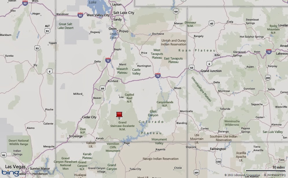
Escalante, Utah
Next…
We were supposed to be at the North Rim of the Grand Canyon 30 Sep-5 Oct. We looked forward to hiking one of the most spectacular places on earth and we looked forward to meeting our Northwood RV Owner’s Association (NROA) friends, Bob and Nancy, who were visiting from Idaho. We cancelled those plans on 29 September when it seemed likely the national parks would close due a government shutdown. Sure enough, on 1 October, the government shutdown and the parks closed. It didn’t impact us too much…We were comfortable and happy to spend another five days in Escalante. Tomorrow we head to Kanab, Utah for a week. We will stay at an animal sanctuary…it will be interesting! We hope to hike to the famed “Wave” and wander the Coral Pink Sand Dunes. Look for the next update in about a week. The adventure continues…
Parting Shots…

Heavy evening clouds over Escalante, Utah


Geese headed south for the winter
(36,720)
I loved this blog as I'm a Brit and did not know much about the area and enjoyed the "off the beaten path" account. Thank you!
ReplyDelete