
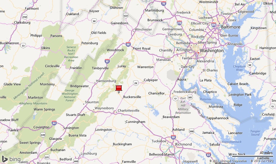

One week in Stanardsville VA…
Why we came…
To explore Shenandoah National Park and Monticello.

The campground…

In the campground
Heavenly Acres Campground was excellent! The sites were quite spacious and most had trees or shrubs that provided privacy. The pads were gravel and a bit unlevel. Satellite appeared to be available in most sites, but the dish would have to moved to avoid obstacles. Cell phone signal was surprisingly decent 4G and wi-fi was only available up on the hill at the office. We didn’t check out the other facilities, but everything appeared to be well maintained. Though it was late in the season, there were quite few visitors during the weekend, but very few during the week. Other than one obnoxious group of partying weekenders, it was totally peaceful. We liked the location and we liked the campground…we’d gladly stay there again!
The best part was that our good friends, Bruce and Liz, joined us for a few days in their new Airstream. The owner was able to set us up with facing camp spots.
Stanardsville VA, population 476 and elevation 663 feet, is at the base of the Blue Ridge Mountains and just 10 miles from the Swift Run Gap entrance to Shenandoah National Park. It’s a sleepy little town with very few stores and restaurants. Ruckersville, seven miles southeast of Stanardsville, has a selection of restaurants, a big Walmart, and a couple of other grocery stores.

Comfortable at Heavenly Acres with Liz and Bruce
Adventures…
Note: We found the following web page very helpful in planning our hikes: Virginia Trail Guide
On 30 October we hiked to Hawksbill…
Hawksbill Peak, at 4,049 feet, is the highest spot in Shenandoah National Park. That may not sound high to us Westerners, but when the valley on either side is 3,000 feet below, it provides a spectacular bird’s eye view! Hawksbill was an obvious choice for our first Shenandoah hike.
It was chilly and windy so we appreciated the internal warmth generated by the uphill workout. After reading so much about the Appalachian Trail (or AT), we were thrilled to be walking a section of it! The views, mostly from impressive rock outcroppings, were incredible. Unfortunately, the trees surrounding us had already shed their leaves, but there was an array of pretty fall colors spread below us.
We were so glad to experience this great hike with our good friends, Liz and Bruce!
Click here for the Virginia Trail Guide description of this hike.


Hike route to the highest peak in the Park / Bruce leaning on a direction post at a trail junction

A glorious view of the Shenandoah Valley along Skyline Drive


A white “blaze” that means we’re on the Appalachian Trail / Bruce and Liz overlooking the Shenandoah Valley

View towards the south from Hawksbill


Hefty me, Arleen, Bruce, and Liz near the top of a breezy Hawksbill
On 31 October we hiked the Big Run Loop…
We wanted a 5-6 mile long loop that descended in elevation amongst a canopy of brilliantly colored leaves. The Big Run Loop proved to be the perfect choice!
We parked at the Doyles River Trail parking area, walked across Skyline Drive, and descended 1,500 feet. As we dropped, more leaves clung to the trees, many of them showing off their amazing fall colors. A thick, two or three inch layer of leaves covered the trail, hiding rocks and roots, making the footing a bit treacherous. Our ankles twisted and turned in every direction and we nearly fell many times, but our hiking poles helped keep us upright.
We crossed Big Run Creek and read the sign that relayed the fishing regulations. There are trout in the creek and I didn’t have my fly rod!
Now we climbed…we had 1,500 feet to make up! It was a steady ascent on a nice trail surrounded by the pretty woods. It was also a good workout! We met a nice couple from DC who were taking a rest. They offered us some Halloween M&Ms which we gladly accepted…good energy food for an uphill hike!
We joined the Appalachian Trail near the top, and followed it for roughly a mile and half back to our vehicle. The trail passes through the Doyles River Overlook, definitely the best view along the hike.
Click here for the Virginia Trail Guide description of this hike.


Big Run Loop hike route / Bruce posing at a stop along Skyline Drive


Kicking leaves off of the trail / Ferns growing out of a crack in the rock


A nice walk in the woods surrounded by an array of fall colors

Will she make it?!?

Looking east from Skyline Drive
On 1 November we hiked the Loft Mountain Loop…
We had breakfast with Bruce and Liz, said goodbye, and headed into Ruckersville for supplies. It was a gray, dreary day and we planned to rest.
We were home around 1pm, but by 2pm, we were antsy to get into the woods. We spontaneously decided to do a short afternoon hike in the Park.
We wound our way south on Skyline Drive to the Loft Mountain Wayside. The trail climbed steadily for about 500 feet to Loft Mountain. We stopped at a rock outcropping and enjoyed the hazy view east towards Chesapeake Bay.
Then we ambled pleasantly along the ridge and stopped at the top of the Discovery Trail. This rock outcropping provided an excellent view west over the Shenandoah Valley. The trees below us still clung to their pretty leaves.
We had this trail, and it seemed this section of Shenandoah National Park, all to ourselves. This was an outstanding hike that we didn’t realize we would do when we woke up that morning…our spontaneity paid off again!
Click here for the Virginia Trail Guide description of this hike.


Loft Mountain Loop hike route / A white “blaze” on the Appalachian Trail

Looking east from Loft Mountain

Looking west
On 2 November we toured Monticello…
Monticello is Thomas Jefferson’s home near Charlottesville VA. Work was started on the original 5,000 acre plantation in 1768 and continued until Jefferson’s death in 1826. The history and beauty of the estate are amazing.
The plantation highlighted the lives of the slaves and indentured servants; how and where they lived, how they worked the fields, and how they served the Jefferson family and guests of Monticello. Inside the home, many of Jefferson’s collections are preserved including his library and scientific instruments. One example is his thermometer he used for weather observations, he took each morning. His bedroom was not designed for aesthetics but rather to be functional for the avid author, reader, and renaissance man. His bed was in the wall between two rooms so he could just roll out and get busy.
We wandered around the garden and over to Jefferson’s grave which is actually a community plot. In every direction was an incredible view of the Virginia countryside. We can see why young Thomas selected that hill to build his future home.

About to tour Monticello…Thomas Jefferson’s home


View from the breezeway that goes through Monticello / Thomas Jefferson’s grave

Impressive with lovely flower garden
On 3 November we hiked to Mary’s Rock…
Our Mary, Arleen’s sister, loves rocks. When we saw “Mary’s Rock” on the map, we had to check it out!
This was a fairly tough hike nearly entirely on the Appalachian Trail. On the way out, it goes up, down, and steep up. On the way back, it goes down, up, and finally down. We climbed a total of roughly 1,400 feet. Much of that was on a rocky trail covered in leaves. We took deliberate, slow steps, doing our best to stay upright. We were thankful for our poles again!
We hardly saw anyone between our start and the Appalachian Trail hut: Byrd’s Nest #3. So we were able to enjoy some incredible westerly views by ourselves. We stopped at the sleep hut, read the various signs, and perused the hiker’s log as we enjoyed a snack. As with any trail log, the entries varied in length, content, and language. Some entries contained drawings, many of them funny and entertaining. Most of the entries warned of a “resident bear” and extremely persistent mice.
We left the hut and started climbing again. Another trail joined ours and we started to see more people. We stayed mostly in the woods and didn’t have many picturesque views. Then we popped out onto the main Mary’s Rock Trail. It was like a highway, wide and well maintained. And there were quite a few people.
Mary’s Rock is impressive. The 360 degree view is even more impressive. We hung out for awhile eating snacks and taking pictures. It was our favorite spot in the Park!
Due to our slow pace on the way in, we were running later than we wanted. We kicked it up a bit on the way back, and thankfully, made it back in one piece.
This was our favorite hike!
Click here for the Virginia Trail Guide description of this hike.


Hike route to Mary’s Rock / An impressive tree


Another white “blaze”…We’re on the AT again! / A perfect fall day


An Appalachian Trail Hut where hikers sleep / Each hut has a log book…there are always interesting notes!


A glorious view!
On 4 November we hiked the Big Flat Mountain Loop…
It was another glorious fall day making our final Shenandoah hike very enjoyable.
We wanted another roughly five mile loop hike and Big Flat Mountain was a good choice. We started at the Loft Mountain Wayside, walked across Skyline Drive and up the closed campground road.
The National Park amphitheater was in a wonderful spot with an expansive view. If we camped there, we’d go to a bunch of Ranger talks!
The trail circled the edge of Big Flat Mountain offering numerous great views. Trails pin wheeled out from campsites to special spots everywhere. If we camped in one of those sites, the individual outcroppings would feel like our own every morning and evening each time the sun put on its special show. It would be a great place to camp!
We spotted our first bear poop! Then within a few hundred yards, we spotted more. Somehow we didn’t step in any of the 15 or so piles, some of them old and some of them very fresh. We did, however, get quiet and slowed our pace, in an effort to see the culprit that left the natural fertilizer. Unfortunately, we did not see any bears, though we did spot a nice whitetail buck.
We stopped again at the big outcropping at the top of the Discovery Trail. That’s a view we’d never tire of! We descended the other portion of the Discovery Trail. It’s a pleasant walk through the woods, but the highlight is a huge rock overhang. The rock is about 30 feet high, 75 feet long, and juts out over the trail a good 15 feet. Not only was it cool to look at, and geologically interesting, but it would certainly provide good shelter from a storm.
We only saw three other people towards the beginning near the amphitheater. Otherwise, we had the trail and seemingly the Park to ourselves…just the way we like it! It was a good way to end our Shenandoah adventure.
Click here for the Virginia Trail Guide description of this hike.


Big Flat Mountain Loop route / A sweet spot for a National Park amphitheater


Outstanding views along the route / Huge overhanging rock

Rays of sun over the Blue Ridge Mountains
Next…
We spent five days in Damascus VA hiking and biking the nearby Appalachian Mountains. Now we are in Cherokee NC exploring Great Smoky Mountains National Park. Our next stop is Sumter and Columbia, SC to visit friends.
Parting shots…

Following the Airstream to Stanardsville VA

A Ranger talk about bears. There are roughly 400-600 bears spread throughout the Park area.

See the little black bear? It was the only bear we saw.
(92,200)
No comments:
Post a Comment