

10 days in the Columbia River Gorge…
Why we came…
To see pretty waterfalls and maybe do some fishing.
The Campground…
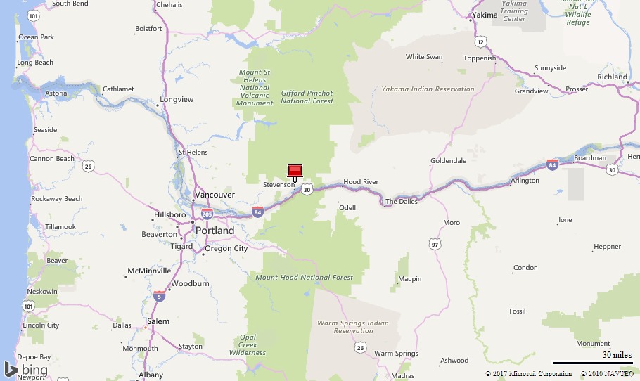
Timberlake Campground and RV Park was great! The narrow winding road to the campground and within the campground are a bit daunting, but they are worth it. Timberlake is likely the only campground within the Gorge that is NOT near a busy road or train track. It’s perched more than 700 feet above the Columbia River in a lush forest and is quite peaceful. The owner/managers, Kyle and Marissa, are also great! They work their tails off, always with a smile, to make everyone happy. They have pride in their business and it shows. Everything is well maintained and kept clean. They are also full of good information about the local area.
The camp sites are all good sized and most of them have privacy. It felt more like a state park than a private one. We had full hook-ups, decent wi-fi, and a consistent 2 bar LTE Verizon phone signal. Satellite would be nearly impossible from many of the sites, but we were able to shoot through a gap between the tall trees. There were no laundry facilities so we washed our clothes in Stevenson.
We really liked the convenient and peaceful location and were very comfortable. We would eagerly return and would love to spent much more time exploring the Columbia River Gorge region!


We really liked Timberlake RV Park
Nearby towns…
Carson WA, population 2,279 and elevation 469 feet, is the closest town to the RV park, about 5 miles to the west. It has a gas station, small convenience store, small hardware store, and a couple of small restaurants. There isn’t much to Carson WA.
Stevenson WA, population 1,465 and elevation 207 feet, is about 9 miles to the west. Though it’s smaller than Carson, it’s a tourist town and has a bigger selection of services, stores, and restaurants. We used the Laundromat which was conveniently next to the decent sized grocery store. The little town seemed busy on the weekends, but otherwise was quiet and cute.
Hood River OR, population 7,167 and elevation 160 feet, is 21 miles to the east. The town is in a beautiful setting wedged between the Columbia River and prominent Mount Hood. It’s clearly an outdoors oriented town with a good selection of outdoor type businesses. There is also a good selection of restaurants, a regular Walmart, and a nice Safeway grocery store. If you can’t find what you need in Hood River, then Vancouver WA and Portland OR are an hour drive to the west of the RV park.
Adventures…
On 3 June we saw four pretty waterfalls…
The goal today was to see waterfalls. It was a bonus that they would be at maximum flow! The area had above average snowfall and it was peak spring runoff. On this adventure, we would see four waterfalls along the Columbia River Gorge: Horsetail, Ponytail, Oneonta, and Triple Falls.
We got an early start since it was a Saturday. We saw Horsetail fall as soon as we pulled into the parking area. It plunges right next to the Historic Columbia River Highway on the Oregon side.
Next, we walked a half mile up the road to make it a loop hike. We spoke with a local sheriff on the highway that was helping with a dog rescue. We could hear the poor pooch barking somewhere up the steep cliffs. By the time we got back the rescue crews were gone. Hopefully there was a happy outcome.
We hit the Oneonta Gorge trail and it pitched steadily up. Plus, it was a little rocky but we only saw one or two other people.
We relished being back in the lush, green forest of the Pacific Northwest. We pointed out all the different sorts of ferns, colorful wildflowers, and the moss dripping all over the huge Douglas trees and maples.
Triple Falls was incredible and we spent some time lingering there. At first it was peaceful with just us and one other couple listening to the roar of the water tumbling over the basalt rocks.
As we waited more people in larger groups started showing up breaking the meditative mood. We reluctantly left.
We picked the Horsetail trail up at a “Y” a bit back down the trail. We saw numerous people along this section of the trail.
We heard Ponytail falls before we saw it. When it came into view, we eagerly followed the trail leading us behind the plummeting cascade of water. The well-worn path makes a sharp U. Though you’re close to the plummeting water, you stay fairly dry. It was just warm enough that the spray was refreshing. It was a cool experience!
We returned to the beginning and Horsetail falls. Now, the parking lot was bursting and cars lined the highway in both directions.


Hike route to Horsetail, Ponytail, Oneonta, and Triple Falls / About to climb the Oneonta Trail


We parked at Horsetail Falls. It’s beautiful!


We like walking through these old tunnels / The lush forest of the Pacific Northwest is incredible


Triple Falls / Oneonta Falls

A point along the trail between Oneonta and Ponytail Falls provided a nice view up the Columbia River. Beacon Rock is on the left.

About to walk behind Ponytail Falls / It was cool to walk behind it!
On 4 June we saw two more waterfalls…
We did two different hikes and each was about five miles long. Beautiful waterfalls awaited.
Hike number one …
The Eagle Creek trail is one of the most popular routes in the gorge so we were sure to arrive early on a Sunday morning. We parked a quarter of a mile away from the trailhead for a quick getaway.
The trail was an easy pitch up. However, there are a few rocky ledges with impressive drop offs. The cliff walls were dripping from hidden springs, covered in moss with intricate little wildflowers and ferns deftly clinging to the wall.
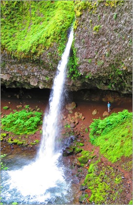
You can do a difficult, 12-mile hike to Tunnel Falls. But, we took a side trail cutoff. The trail drops a quarter of a mile to Eagle Creek and a pebble beach.
We were able to see Punch Bowl falls by step-stoning carefully out about ten feet from the beach. The incredible 30 foot Punch Bowl falls are up a steep, narrow canyon. The canyon was dripping with moss and huge ferns.
Amazingly we had it all to ourselves for a while. The trail seemed crowded but most of the people were headed up to the Tunnel Falls, another 4 miles up the trail.
We were serenaded by multiple birds as we climbed out of the scenic canyon.
Arleen wondered if anyone used the iron chains imbedded into the walls where the trail crosses a narrow ledge with a precipitous drop to Eagle Creek. Two minutes later, we moved to the left of the trail to let a terrified woman pass as she clung to the chain.


Hike route up the Eagle Creek Trail to Punchbowl Falls / The trail starts about a quarter mile from here


The dripping fern and moss covered walls were very pretty / Walking through the moss draped forest

It dropped at least a hundred feet off some sections of trail. See the steel cable on the left? A few people held it with a death grip!


About to drop to Punchbowl Falls / Contemplating the incredible beauty / Long wall of ferns dripped continuously into the creek

Punchbowl Falls is beautiful
Hike number two …
We parked at the Bridge of the Gods at Cascade Locks. Before beginning the hike, we got some incredible pictures of the Cascade Locks garden with the bridge in the background.
Next, we hurried over to the Pacific Crest Trailhead (PCT) trail head. We posed for a picture to send to our friend Jen, who along with her husband Bill, had hiked the entire 2,650 mile long PCT two years before. Most impressive!
We had to walk a short distance to get to the actual trail. First we walked under the steady traffic traversing I-84. Then we had to cross a street and walk up an old road before our feet set down on the actual long distance PCT. Fortunately, it is all clearly signed.
The traffic noise faded and soon all we noticed as we hiked up the lovely trail was the old Douglas fir forest and the carpet of sword ferns. After a few miles, we took a right off the PCT.
We hiked just another quick quarter mile up the trail and we were treated to a beautiful view of the Dry Creek Falls. The name is deceiving. They are not dry!
Impressive, cathedral bluff walls are covered with ferns and mosses. Just below the 50-foot falls a series of rock steps allowed the creek to tumble through all sorts of ferns. It was just so pretty!
We took time taking pictures and chatting with the few other people who were there. It was our favorite falls so far.


Hike route to Dry Creek Falls / We were excited to hike a sliver of the 2,650 mile long Pacific Crest Trail


This is a cool mural on the Bridge of the Gods / Rhododendrons, Bridge of the Gods, and the Columbia River

Dry Creek Falls
On 5 June we did a bike ride on the old historic Columbia River Highway…
“The Historic Columbia River Highway is an approximately 75-mile-long scenic highway in Oregon between Troutdale and The Dalles, built through the Columbia River Gorge between 1913 and 1922. As the first planned scenic roadway in the United States, it has been recognized in numerous ways, including a listing on the National Register of Historic Places as a National Historic Landmark, … and considered a "destination unto itself".
From the very beginning, the roadway was envisioned not just as means of traveling by the then popular Model T, but designed with an elegance that took full advantage of all the natural beauty along the route.”
Now, the old highway from Hood River to Mosier is a 4.8 mile traffic free area reserved for bikers and walkers. It was a fun, rolling bike ride!
We had a great view of Columbia River at two different overlooks. We especially enjoyed gliding through one of the original tunnels.
Hood River is closer to the dry side of Oregon but this section of highway stays in the dark lush forest. Also, the wildflowers were peaking. Flowers such as the wild butterfly bush smelled very pleasant.
We did not see any wildlife but we were on the lookout for rattle snakes after seeing a warning sign at the visitor center.


Bike route on the old Columbia River Highway / Plaque where we started


Looking down the Columbia River from the first overlook / Posing between the two tunnels

Looking both up and down the Columbia River from the second overlook
On 6 June we hiked the Hood River Mountain Ridge Trail…
We parked by a gate on Old Dalles road high above and southeast of Hood River. It was marked in accordance with the instructions we had found in the Day Hikes in the Columbia River Gorge book that we borrowed from the campground owners.
We hiked a mile and a half up the steep, rocky Hood River Mountain Ridge Trail.
The scenery at the top made the effort well worth it!
The knob at the top provided an incredible panorama of Mount Adams, Mount Hood, and the Columbia River Gorge. The town of Hood River was far below, obviously set in an outdoors paradise. Unfortunately, some wildflowers were already past their peak. Fortunately, some lupine and paintbrush provided a nice foreground to the dramatic snow covered volcanoes.
We took a slow sloping two mile road back to Old Dalles road to make it a pleasant three and a half mile loop.


Hike route on the Hood River Mountain Ridge Trail / Posing near the top. Mount Hood, 11,250 feet high, is just 20 miles to the southwest

Hiking up the trail. Mount Adams, 12,280 feet high, is 35 miles to the north.

The trail along the ridge is very pleasant and has fantastic views


Bouquets of pretty wild flowers lined parts of the trail.
On 7 June I went salmon fishing…
I hadn’t fished for salmon in six years. It was time!
Every year millions of salmon swim up the Columbia River in route to their spawning grounds. When you’re in the right place at the right time, the fishing can be a blast.
Kyle, the hard working campground owner, is an avid fisherman and generously shares fishing info. He recommended either Drano Lake, where I’d have the best chance to catch something, or the Wind River, where I’d have a more pleasant experience. I chose the Wind River.
I launched the kayak and paddled under the road and train bridges, out to the Columbia River. I fished the deep channel where the Wind River mixes with the Columbia River for a couple of hours and got nothing. The five or six fishermen on the point and a few others in small boats didn’t hook any either.
It was cool to be on the Columbia. Big barges slowly cruised up the middle and an occasional train chugged along either side of the big river. A regal bald eagle kept me company for a while as it pecked on a dead fish nearby.
I switched fishing tactics and targeted bass along the rugged bank. The Columbia supposedly has a good population of bass, but I didn’t see any!
Next, I paddled back under the two bridges and worked my way slowly up the Wind River. I thought the Indian fishing platforms were really interesting. Too bad they weren’t fishing. I would have enjoyed watching.
Just a little upstream of the fishing platforms, the current got too strong to continue. I beached the kayak, hopped out, and started throwing a blue vibrax spinner into the deep channel of the sweeping bend. This is exactly how I fished in Alaska and those special memories flooded over me. Mostly, I reminisced about my fishing partner, Ken. Sadly, he was killed in a motorcycle accident in Korea. We spent a lot of time in canoes and tents and fishing just like I was now. I miss you buddy.


Kayak route on the Wind and Columbia Rivers / I watched this eagle take its time to eat a dead fish


Just launched on the Wind River and headed under the bridges to the Columbia River / Fishermen on the point and in small boats trying to hook salmon. We all got skunked. The barge is slowly cruising up the middle of the huge river.


A great blue heron patiently fishing in the shallows / My only fish, a juvenile king salmon. The Indian fishing platforms were interesting. Too bad they weren’t fishing at the time.
On 10 June we tried to make it to Goose Lake…
After a few days of rain, we were ready to get out. My research indicated that Goose Lake was pretty and had good fishing for multiple kinds of trout. It would be a good hour drive to get there along twisting narrow forest roads.
We drove up through Carson and took a right on Forest Road #65. We were surprised that it was paved but it was a winding, one lane route with few pullovers for passing oncoming traffic. Also there were numerous branches hanging low over the road. With the kayaks on the truck, we proceeded carefully to make sure that we could squeeze under the branches. It was slow going.
Finally, we took a right on Carson Guler Road. Now it was a dirt road. We mildly noticed a few patches of snow in the woods. Then suddenly, just 4.6 miles from our goal, we were thwarted by one to two feet of old snow covering the road. We were just at 3,500 feet elevation and it was a chilly 45 degrees!
Since we were not going to make it to Goose Lake, we poked around in the woods. We saw some Amanita mushrooms that were a yellow color. The area was very shroomy with pretty dogwoods, mixed Spruce, maples, and ferns littering the forest floor.
Since the way up was precarious, we took Forest Road #60 back. Regrettably, it was cluttered with even more low overhanging branches. In addition, there was a lot of tree debris on the road.
I had to get out a couple of times to break branches even though we were just a few short miles from the highway.
It was an adventure but not the sort of adventure that we had set out to do. We checked the snow chart when we got back. The Gifford Pinchot forest area is still at 230% normal snow depth water equivalent. Well we found that 230%!!!

Drive route to Goose Lake


Stopped by 1-2 feet of old snow just four miles from the lake / Lots of debris and low hanging limbs along the narrow winding forest roads
Next…
We are in La Grande OR and our next stop is McCall ID. We don’t know where we’ll be after that. Sadly, Arleen is having significant back problems. We may spend the summer in Missoula MT to get her fixed! Stay tuned…
Parting shots…

The drive across the narrow Hood River Bridge was stressful. NOT recommended for big vehicles!

The bridge trolls made us chuckle each time we crossed the Bridge of the Gods


A banana slug / A colorful garter snake
(173,900)
No comments:
Post a Comment