Home is where we are parked

Home is where we are parked

Sunday, July 24, 2011

MT –- Libby Dam, 14-21 July 2011


Map picture


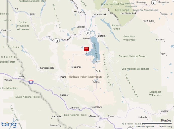
We spent a week near Libby Dam and Lake Koocanusa in the northwest corner of Montana.  We kayaked, biked, hiked, fished, and even played frisbee golf…This area is great!

The metropolis of Libby has less than 3,000 people.  It’s the population center in this part of Montana.  The region is quiet and uncrowded…just the way we like it!  Even during the weekend we noticed only a few more people out playing. 

Our camp site had full hook ups (i.e. water, electric, and sewage) so we were very comfortable.  There was zero cell phone coverage, spotty wi-fi internet, and spotty satellite TV.  This made it tricky when we got an offer to buy our house, but we made it work.  Hopefully the house sells soon…stay tuned on that one.

The Army Corps of Engineers manages Libby Dam.  There is a great visitor center and multiple recreation sites on Lake Koocanusa and the Kootenai River.  The facilities are impressive and the tour of the dam was really interesting.  The picnic and boat launch area near the visitor center are top notch with group sites and a nice swim area.  They even have an 18-hole frisbee golf course through the woods.  A couple of the holes teeter above the lake ensuring a lost frisbee with an errant throw.  We were really impressed with the Corps of Engineers facilities and will eagerly seek them out again in the future.

Libby dam3 - 16 July 2011    Libby dam13 - 19 July 2011


There are good paved roads for road cycling and seemingly endless dirt forest roads begging to be mountain biked.  We especially liked the 8-mile loop along each side of the river, though the final half mile climb out of the river valley has a 10 to 12% gradient.  It was great exercise!

Libby Dam MT - ride - 16 July 2011    Libby dam11 - 19 July 2011


We also kayaked about 3 miles of the river just below the dam.  The current moves along at 2-3mph and is an easy class I float (no significant dangers).  It was very peaceful.  We saw multiple eagles and ospreys perched in trees and soaring above the river waiting to pounce on trout.  I also made mental notes on potential fishing holes.

Libby dam12 - 19 July 2011    Libby dam14 - 19 July 2011


We hiked to the top of Alexander Mountain.  The vegetation was pretty thick and the trail was hard to follow in spots.  It was obvious that the trail is used sparingly.  This is bear country and we were on alert after finding a few piles of bear poop on the trail!  So to avoid surprising any bears, Arleen and I told them loudly and repeatedly that we didn’t taste good.  We also saw a lot of evidence of deer and moose, but didn’t see any critters.  We climbed about 2,000 feet to the top of Alexander Mountain and couldn’t see much through the trees.  However, we had a few great views along the way and got an excellent workout.

Libby Dam MT - hike - 17 July 2011    Libby dam6 - 17 July 2011

Libby dam5 - 17 July 2011    Libby dam7 - 17 July 2011

                                                                                          Bear poop!  “Go away bear. We don’t taste good!”

We finally got fishing licenses!  We fly-fished for trout in the lake, Kootenai River, and Fisher River.  We caught rainbow trout that ranged 3-13 inches and one endangered bull trout that was about 17 inches long (released immediately!).  Many of them were caught with floating flies on top of the water.  It’s a blast to see the trout come up and attack the fly!  We ate one of the trout…it was yummy!  It’s been awhile since we fished like this.  There will be much more of it in the future.

Libby dam1 - 16 July 2011    Libby dam2 - 16 July 2011

Libby dam4 - 16 July 2011    Libby dam10 - 17 July 2011

                                                                                                           Surf and turf night…yum yum!

We did a lot the week we were here, but we’d happily stay for a month or two.  We’ll be back!

Wednesday, July 20, 2011

MT -– Flathead Lake, 10-14 July 2011


Map picture


Flathead Lake is a gem!  The largest freshwater lake west of the Mississippi is surrounded by mountains with stunning views in every direction. 

We stayed at Big Arm State Park on the west side of the lake.  Most of the campsites are reserved well advance, but we got a “first come, first served” site in a good location.  We had a nice view from the trailer and it was peaceful.  There were no hookups (i.e. water, electric, sewage), but we knew we’d be comfortable during our 4-night stay.

The main thing we wanted to see was Wild Horse Island (http://fwp.mt.gov/parks/visit/wildHorseIsland/).  We kayaked 4 miles to the island and then hiked to the top of the highest point on the west side.  During the 8-miles of paddling, we looked for Flathead Lake’s “Nessie” (http://en.wikipedia.org/wiki/Flathead_Lake_Monster).  Sadly, she didn’t show herself.  However, during the hike we saw three large deer with growing antlers…the deer were impressive.  At the top, an eagle soared above and we were blown away by the 360 degree view. 

Flathead Lake MT - paddle and hike - 12 July 2011    Flathead Lake MT4 - 12 Jul 2011

                                                                                                                   See the two deer?

Flathead Lake MT5 - 12 Jul 2011

Flathead Lake MT11 - 14 Jul 2011


We also stumbled onto a great 6-mile hike.  After consulting various maps of the area, we were unable to find any designated hiking trails nearby.  However, there were quite a few “4WD” roads.  We picked one that climbed a hill on the south side of the lake that had potential for a great view at the top.  Good call…  The view was amazing!  Sometimes trekking into the unknown pays off and sometimes it doesn’t.  When it does, it’s special and leaves us with great memories.

Flathead Lake MT - hike - 11 July 2011    Flathead Lake MT2 - 11 Jul 2011


We could easily spend an entire summer getting to know this area intimately, but we must move on.  Our next stop is Lake Koocanusa near Libby in the northwest corner of Montana.  Ahhh…life is good!

Friday, July 15, 2011

MT–– Canyon Ferry Lake, 5-10 July 2011


Map picture

Back in the great outdoors!  Beautiful views, kayaking, biking, and hiking…what a great place!

We stayed at White Earth campground, a Bureau of Reclamation site, on Canyon Ferry Lake about 15 miles southeast of Helena Montana.  We had no hookups (also known as “boondocking” or “dry camping”), but were able to fill our freshwater tank at the entrance to the campground.  The solar panels and batteries provided adequate electric and conserving water made it easy to enjoy this area for 5 days.

We were camped just a few feet from the water and had great views, especially out the front door…

Canyon Ferry MT13 - 8 July 2011    Canyon Ferry MT11 - 6 July 2011

As I sat in the recliner and stared at the rippling water and distant mountains through the front door it occurred to me that people pay tons of money to have a house with views like this.  The view, the site, and all of the fun things to do were ours for only $8 a night!

6 July was a banner day for us.  We biked 17 miles, hiked 3 miles, and kayaked 4 miles.  We were a bit sore the next day, but the memories were worth it!  The pair of ospreys during the bike ride and the awesome sunset during the kayak paddle were amazing…

Canyon Ferry MT - ride - 6 July 2011    Canyon Ferry MT - hike - 6 July 2011

Canyon Ferry MT - paddle - 6 July 2011    Canyon Ferry MT6 - 6 July 2011

Canyon Ferry MT5 - 6 July 2011


Lessons learned this round…

- We prefer to park the trailer east-west if possible.  Orienting this way allows us to have full sun or full shade as desired.  Our best view is out of the “curb side” or passenger’s side of the trailer. 

- We can stay “off the grid” “boondocking” for 5 nights if we conserve water.   We took 6 showers (total) and avoided getting too funky!

- We can tolerate mid-90F heat without air-conditioning and very little shade!  However, we do need a little breeze and the “Fantastic Fan” to make it bearable.  The “Fantastic Fan” draws air out of the trailer at the ceiling/roof which increases the flow into the trailer from the windows.  We can run the fan 24/7 because it uses minimal electricity and the inside of the trailer stays within a few degrees of the outside temperature.  Without the fan and a little breeze, the trailer would turn into an oven.

- We paddle our kayaks just over 3mph on flat water in no wind. 

- Never leave our dog chained up unsupervised outside of the trailer.  He can escape!

We’d love to come back.  This is going to be hard to beat…

Canyon Ferry MT7 - 5 July 2011

Sunday, July 10, 2011

MT–– Roundup, 12 June – 5 July 2011


Map picture

We spent about three weeks in Roundup, Montana to help Arleen’s mom, Ellen, with things around her house.  She just got back home after spending the last six months in Kansas successfully fighting cancer.  Hopefully we have made her day to day life easier.

The “RV Park” we stayed in was a dive.  At $10 a night, you get what you pay for.  Thankfully we had full hook ups, but paid extra for electricity (~$35).  The post office was right outside our bedroom window.  The mail truck showed up between  5:30 and 6:00am Monday-Friday.  Nearly everything was within walking distance so the convenience was nice.  Surprisingly, the main road through Roundup is quite busy.  Our campsite was peaceful only very late and very early each day.  We would only stay here again if we had to.

We tried to exercise every other day.  The workouts included 30-45 minutes of calisthenics done inside the trailer followed by either a 3+ mile hike or 10+ mile bike ride.  We are leaving here in better shape, but will continue to work towards our fitness goals.

Here are a few of our more memorable hikes and bike rides…

Roundup MT bike ride - 15 June 2011    Roundup MT bike ride - 18 June 2011

            24.5 mile bike ride – 15 June 2011                                   27.3 bike ride – 18 June 2011


Roundup MT walk - 22 June 2011    Roundup MT walk - 24 June 2011

                           3.6 mile walk – 22 June 2011                                               5.7 mile walk – 24 June 2011   


Roundup MT bike ride - 27 June 2011    Roundup MT walk - 1 July 2011  

               20.2 mile bike ride – 27 June 2011                           4 mile walk with Mary and Heather – 1 July 2011

The flooding that ravaged this little town in late May and the first half of June also wreaked havoc with our bike rides and walks.  On many occasions we found ourselves in deep mud, rode or walked through water, and were turned away by closed roads.  I am a snowboarder, often referred to as a “snowboarding punk” by our two-planker, skiing friends.  My wife is told repeatedly not to follow the snowboarder because it gets her into trouble.  She should heed that advise more often!

On 18 June, we planned a 15-mile bike loop that would have taken us over the flooded Musselshell River twice.  The route included about 8 miles of riding on Hwy 12 which doesn’t have much of a shoulder and has a steady flow of large vehicles.  The pucker factor is high each time a semi-truck wizzes by at 60mph just a couple of feet away.  I decided we’d start our loop on the highway as we’d have fresh legs and a 20-25mph tail wind.  The ride out was great!  We cruised along effortlessly at 20-25mph and the big rigs were able to give us a wide birth whenever there was no opposing traffic.  We got to the first bridge……it was closed.  Now we had a decision to make: 1) head back on the highway, crawling against the wind; or 2) try a different route.  Arleen wanted to head back on the highway and I searched for a different route.  We chose a different route…big mistake!  The first 3 or 4 miles were nice on a decent gravel road with great views of “Big Sky” country.  Unfortunately, it all went downhill when we made a left turn on what Arleen called the “cow pie road”.  The “road” was used sparingly by trucks and tractors.  It was rough with loose gravel, often rutted, muddy in spots, and had many cattle grates.  Speaking of cattle, we came across a bull with a harem of about 30 of his women.  About 100 yards away, Arleen and I got off of our bikes hoping the bull and his harem would move away.  He starred at us for a few tense minutes, rounded up his women, and took off….stampede!  Thankfully they headed the other direction.  We usually see cows standing passively in fields.  It’s a bit unnerving when 30 of them decide to move in a hurry and you have nowhere to hide!  Shortly after showing the bull who was boss (yah right!), we were about 15 miles and 90 minutes into our bike ride, maneuvering around the cow pies when the ruts and gravel got the best of Arleen…wipe out…she bruised her right leg.  Within a few hundred yards, we crested a little hill and saw a large pond (roughly 200 yards wide and 400 yards long) blocking the “cow pie road” ahead of us.  Decision time again:  1) turn around and go back; 2) walk a long ways around the pond in swampy grass towards 30 or 40 more cows (didn’t see a bull); or 3) walk through the middle of the pond in knee deep water and mud.  Arleen followed the snowboarder right through the middle of the pond.  It wasn’t bad,  but now we and our bikes were loaded down with mud.  Arleen’s clip-in bike shoes and clip-in bike pedals became useless.  We thought we got them clean, but Arleen crashed shortly after hopping on her bike.  This time she lost a bunch of skin on her leg.  We were over 2 hours into the ride and wanted it to end, but we had 10-15 miles to go so we pressed on.  Within a half mile, the ruts, gravel, and muddy equipment struck again!  Crash number 3 resulted in more lost skin on her knee, a nasty bruise on her hip, and banged up elbow.  She was a wreck!  When was this $*#%! ride going to end?!?  What clown chose this route?!?  Were we on the verge of divorce?!?  We had a snack, drank water, gathered our wits, and then pressed on.  We took it easy the last 8-10 miles and got back without incident.  Instead of the 15-mile loop we planned, we ended up doing 27 miles and were out for 3 and a half hours.  As I type, Arleen’s left calf, left knee, right quad, left hip, and left elbow have bruises of various sizes and colors.  Moral of the story:  don’t follow the snowboarder!


Some highlights of our stay in Roundup, Montana:

- Pictograph Cave State Park near Billings on 13 June 2011…

Petroglyphs State Park MT1 - 13 June 2011    Petroglyphs State Park MT2 - 13 June 2011    Petroglyphs State Park MT3 - 13 June 2011

                                                                     See the marmot?


- A day trip to the Absaroka-Beartooth Wilderness near Nye, Montana on 29 June 2011 with Ellen, Mary and Heather…

Woodbine trail MT hike - 29 June 2011    Woodbine trail MT1 - 29 June 2011   

Woodbine trail MT2 - 29 June 2011    Woodbine trail MT3 - 29 June 2011    Woodbine trail MT4 - 29 June 2011

Great hike on the Stillwater trail in Montana–29 June 2011


- Our hikes and bike rides around the area…

Roundup MT5 - 17 June 2011    Roundup MT2 - 15 June 2011    Roundup MT6 - 23 June 2011


Next we will work our way back to Washington.  The first stop will be Canyon Ferry Lake just east of Helena, Montana… back to the great outdoors!